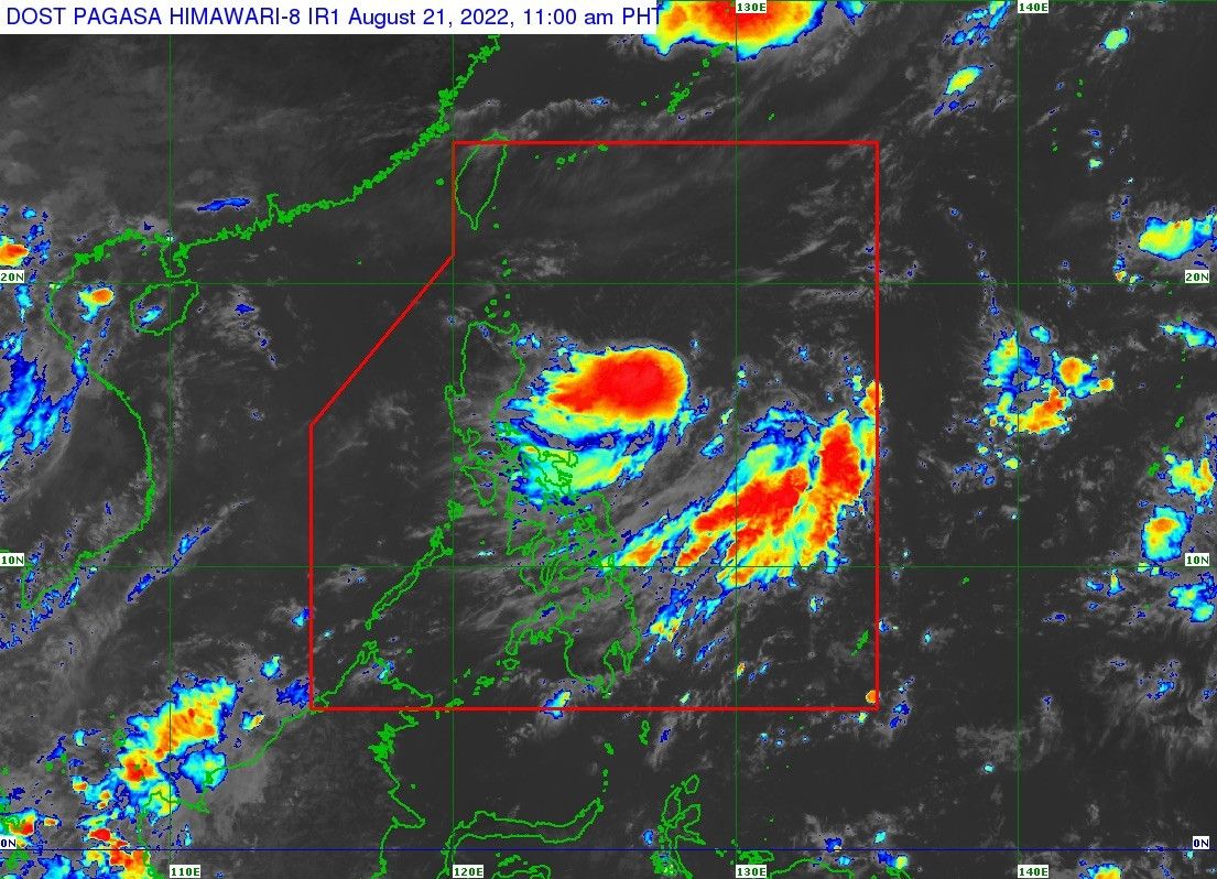
'Florita' projected to make landfall in northern Luzon on Tuesday

MANILA, Philippines — State weather bureau PAGASA said tropical depression Florita is expected to make its landfall on Tuesday within Cagayan or the northern portion of Isabela.
Florita developed into a tropical depression on Sunday morning and PAGASA sees it moving slowly southwestward in the next 12 hours before moving towards Northern Luzon on Monday.
"This tropical cyclone is forecast to reach tropical storm category in the next 36 hours and may reach peak intensity of 75 km per hour prior to making landfall on Tuesday morning or afternoon,” the state weather bureau said in its 11 a.m. bulletin.
"Slight weakening is likely as it crosses the Northern Luzon, but it is forecast to remain within the tropical storm category."
For now, Florita is "not directly affecting the country." However, by Monday morning to afternoon, areas within the east of Northern and Central Luzon are expected to experience light to moderate, and at times heavy rains.
Meanwhile, from Monday evening until Tuesday, the tropical depression is anticipated to bring heavy to intense rains.
"There is a high likelihood that Tropical Cyclone Wind Signals (TCWS) will be hoisted for Northern Luzon and several provinces in Central Luzon due to the threat of strong to storm-force winds associated with the passage of ‘Florita,’" PAGASA said.
It said a TWCS 1 may be hoisted over affected areas in the eastern section of Northern Luzon on Sunday afternoon, with signal number 2 being the highest possible warning for the tropical depression.
- Latest
- Trending


