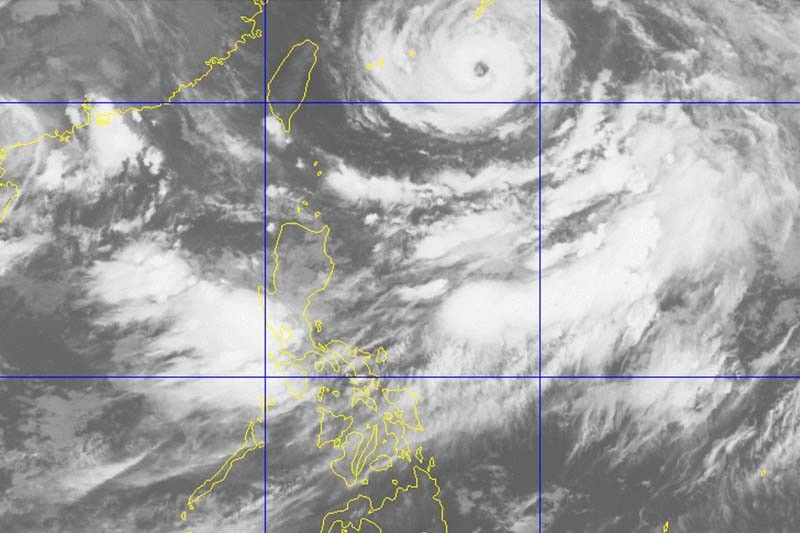
Typhoon Fabian decelerates; southwest monsoon affects Philippines

MANILA, Philippines — Typhoon Fabian (In-fa) slightly decelerated early Wednesday morning, while the southwest monsoon (habagat) continued to bring rains over parts of the country, state weather bureau PAGASA said.
Fabian was last spotted 740 kilometers east northeast of Itbayat, Batanes, heading west southwest at only 10 km per hour.
It had maximum sustained winds of 130 kph near the center and gusts of up to 160 kph.
What to expect
PAGASA said the typhoon is not expected to bring heavy rainfall throughout the forecast period.
Meanwhile, the hoisting of Tropical Cyclone Wind Signal No. 1 over Batanes and Babuyan Group of Islands “remains a possibility.”
Fabian and Severe Tropical Storm Cempaka—a cyclone outside the Philippine Area of Responsibility—continued to enhance the southwest monsoon.
Monsoon rains will be experienced over the following areas in the next 24 hours:
- Ilocos region
- Cordillera Administrative Region
- Batanes
- Babuyan Islands
- Zambales
- Bataan
- Tarlac
- Pampanga
- Bulacan
- Metro Manila
- Cavite
- Batangas
- Occidental Mindoro
- Northern portion of Palawan (including Calamian and Kalayaan Islands)
Due to southwest monsoon, Western Visayas and the rest of Luzon with have cloudy skies with scattered rainshowers and thunderstorms. Meanwhile, the rest of the country will have partly cloudy skies with rainshowers or thunderstorms.
Rough to very rough seas (2.5 to 4.5 meters) will be experienced over the seaboards of Batanes and Babuyan Islands, and the western seaboard of Palawan (including Kalayaan and Calamian Islands) and Occidental Mindoro (including Lubang Islands).
Moderate to rough seas (1.5 to 3 meters) will prevail over the eastern and the rest of the northern and western seaboards of Luzon.
Fabian is forecast to leave the Philippine Area of Responsibility on Saturday morning. — Gaea Katreena Cabico
- Latest
- Trending


