Signal No. 2 still up over parts of Pangasinan due to Tropical Storm Dante
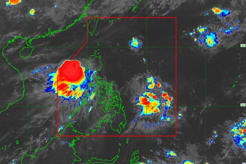
MANILA, Philippines — Tropical Storm Dante (Choi-wan) was moving over the coastal waters off Pangasinan Thursday morning after crossing Luzon, state weather bureau PAGASA said.
Dante was already 145 kilometers west northwest of Dagupan City, Pangasinan, according to the latest weather bulleting. It was packing maximum sustained winds of 65 km per hour near the center and gusts of up to 90 kph.
It was moving west northwest at 35 kph.
PAGASA said the tropical storm will continue moving north northwestward in the next 12 hours before turning north northeastward on Tuesday afternoon or evening and northeastward on Friday morning. It is expected to be over the Bashi Channel on Friday.
Dante is forecast to weaken into a tropical depression within the next 12 hours.
Signal No. 2 (Damaging gale-force winds prevailing or expected within 24 hours)
- Western portion of Pangasinan (Dasol, Mabini, Burgos, City of Alaminos, Agno, Bani, Bolinao, Anda)
Signal No. 1 (Strong winds prevailing or expected within 36 hours)
- Central portion of Pangasinan (Bugallon, Lingayen, Binmaley, Dagupan City, Mangaldan, Calasiao, San Carlos City, Aguilar, Mangatarem, Urbiztondo, Labrador, Infanta, San Fabian, Sual)
- Northwestern portion of Tarlac, (San Clemente)
- Northern portion of Zambales (Santa Cruz, Masinloc, Palauig, Candelaria, Iba)
PAGASA said Dante is forecast to bring moderate to heavy rains over the following areas:
- Pangasinan
- Zambales
- Bataan
- Occidental Mindoro including Lubang Islands
- Calamian Islands
Meanwhile, light to moderate with at times heavy rains are expected over:
- Ilocos Region
- Cordillera Administrative Region
- Tarlac
- Pampanga
- Bulacan
- Metro Manila
- Rizal
- Laguna
- Cavite
- Batangas
- Oriental Mindoro
- Northern portion of mainland Palawan including Cuyo Islands
Rough to very rough seas (2.5 to 4 meters) will be experienced over:
- Seaboards of areas where Signal No. 2 is in effect.
Meanwhile, there will be moderate to rough seas in these areas:
- Areas where Signal No. 1 is in effect
- Remaining seaboards of Northern Luzon (1.5 to 3.5 m)
- Remaining seaboards of Central Luzon
- Seaboards of Extreme Northern Quezon including the northern and eastern coastal waters of Polillo Islands (1.5 to 2.5 m)
— Gaea Katreena Cabico


- Latest
- Trending