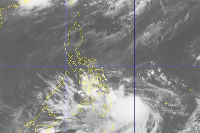
'Dante' now a tropical storm, rain expected in Mindanao areas

MANILA, Philippines — Tropical depression Dante has intensified into a tropical storm early Monday and is forecast to bring rains over parts of Mindanao, state weather bureau PAGASA said.
“Dante”—last spotted 625 kilometers east of Davao City—now packs peak winds of 65 kilometers per hour (kph) near the center and gusts of up to 80 kph.
It is moving north northwestward at 15 kph.
What to expect
PAGASA said the hoisting of Tropical Cyclone Wind Signals (TCWS) over any area in the country remains “less likely.” But “any further westward shift in the track forecast or expansion in its wind radius” may lead to the hoisting of TCWS over the eastern part of the country.
Due to the outer rainbands of “Dante” light to moderate with at times heavy rains will be experienced over the following areas:
- Caraga
- Davao region
- SOCCSKSARGEN
- Bukidnon
- Misamis Oriental
Isolated to scattered flooding, including flash floods, and rain-induced landslides are possible, especially in areas that are highly susceptible to these hazards.
The tropical cyclone will likely remain over the Philippine Sea throughout the forecast period, the weather bureau said. It is expected to gradually intensify in the next two days before it weakens.
Forecast positions
- Monday afternoon: 495 km east of Hinatuan, Surigao del Sur
- Tuesday morning: 430 km east of Surigao City, Surigao del Norte
- Tuesday afternoon: 250 km east of Guiuan, Eastern Samar
- Wednesday morning: 225 km east of Catarman, Northern Samar
- Wednesday morning: 185 km east northeast of Virac, Catanduanes or 300 km east of Daet, Camarines Norte
- Thursday morning: 390 km east of Baler, Aurora
- Friday morning: 435 km east of Calayan, Cagayan
- Saturday morning: 1,010 km east northeast of extreme Northern Luzon
— Gaea Katreena Cabico
- Latest
- Trending


