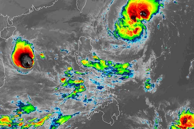
Signal No. 1 up over parts of Cagayan, Babuyan Islands due to 'Siony'

MANILA, Philippines — Storm signal has been hoisted over parts of Cagayan and Babuyan Islands due to Tropical Storm Siony (international name: Atsani), the state weather bureau said Wednesday morning.
PAGASA placed the following areas in extreme Northern Luzon under Tropical Cyclone Wind Signal No. 1 in anticipation of strong breeze to near gale force associated with Siony:
- Northeastern portion of mainland Cagayan (Santa Ana, Gonzaga)
- Eastern portion of Babuyan Islands (Balintang Islands, Babuyan Island, Didicas Island and Camiguin Island including their adjoining islets)
TCWS No. 2 can be hoisted over these areas. Weather forecasters are also not ruling out the possibility of raising TCWS No. 3 in areas near or along the projected track of the storm.
Siony—the 19th tropical cyclone this year—was last spotted 700 km east of Basco, Batanes packing peak winds of 85 kph and gusts of up to 105 kph.
PAGASA said the tropical storm is expected to move slowly or remain almost stationary in the next 12 hours. Then, it will head westward or west-northwestward toward Luzon Strait and extreme Northern Luzon, bringing the center of Siony over or very close to Batanes and Babuyan Islands between Thursday evening and Friday morning.
Landfall over Batanes or Babuyan Islands remains likely.
Siony is seen to strengthen into severe tropical storm in the next 24 hours and reach its height of 100 to 110 kph Thursday ahead of its possible landfall or close approach over extreme Northern Luzon.
“Intensification into typhoon category is not ruled out at this time,” PAGASA said.
Siony and Rolly, which exited the country’s territory Tuesday evening, will bring strong breeze to gale-force winds with higher gusts over Batanes, Babuyan Islands and the northern coastal areas of Cagayan and Ilocos Norte.
Meanwhile, the combined effects of the northeasterlies and the extension of Siony will dump light to moderate with at times heavy rains over Aurora, Quezon, Camarines Norte, Camarines Sur, Catanduanes, and eastern portions of Cagayan and Isabela.
Sea travel is risky over the entire seaboards of Northern Luzon, northern seaboard of Camarines Sur, northern and eastern seaboards of Catanduanes, and seaboards of Aurora, Camarines Norte, Kalayaan Islands and northern Quezon (including the northern and eastern coastal waters of Polillo Islands) due to rough to very rough seas.
Forecast positions
- Thursday morning: 520 km east of Calayan, Cagayan
- Friday morning: 25 km northwest of Calayan, Cagayan
- Saturday morning: 595 km west of Basco, Batanes
- Sunday morning: 910 km west of Northern Luzon
- Monday morning: 1,390 west of Central Luzon
— Gaea Katreena Cabico
- Latest
- Trending


