PAGASA: Tropical Storm Siony may develop into typhoon
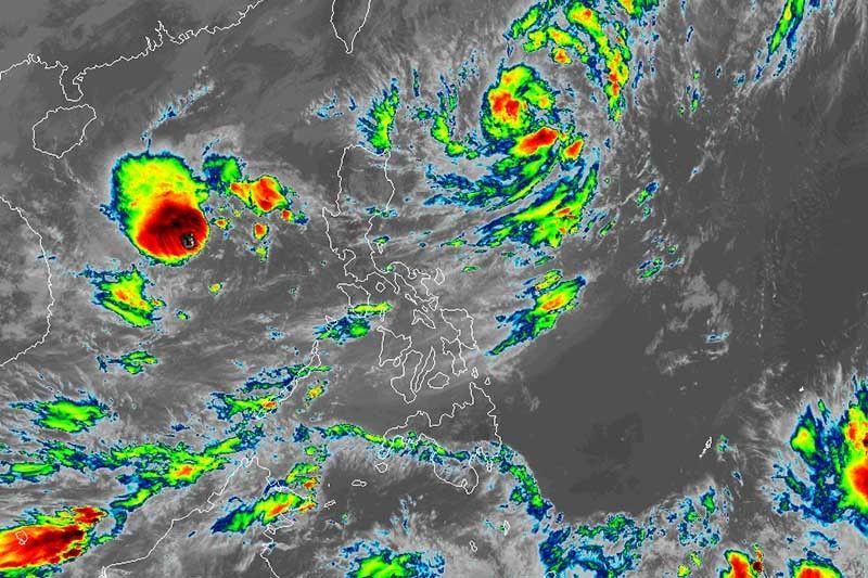
MANILA, Philippines — Tropical Storm Siony (international name: Atsani) may reach typhoon category ahead of its close approach or landfall over extreme Northern Luzon later this week, state weather bureau PAGASA said.
Siony is expected to develop into severe tropical storm in the next 24 to 36 hours and it is likely to intensify into typhoon Thursday before it grazes or hits the land over extreme Northern Luzon.
The tropical storm is expected to move slowly or almost stationary in the next 24 hours. Then, it will head westward toward extreme Northern Luzon.
PAGASA said a landfall scenario over Batanes-Babuyan Islands area on Friday is possible.
“However, due to the projected quasi-stationary state of this tropical storm, there remains a high degree of uncertainty in the forecast track,” it said.
At 10 a.m., PAGASA said Siony was last seen 565 kilometers east of Basco, Batanes. Currently, it is bearing peak winds of 85 kph from the previous 65 kph and gusts of up to 105 kph from the previous 105 kph.
Light to moderate with at times heavy rains are expected over Batanes, Apayao, Cagayan and Isabela due to the combined effects of the northeasterlies and the extension of Sinoy.
Meanwhile, the northeasterlies boosted by Siony and Rolly will bring strong to near gale conditions with higher gusts over Batanes, Babuyan Islands and the northern portions of Cagayan and Ilocos Norte.
Sea travel is risky, especially for those using small seacrafts, over the seaboards of Northern Luzon due to rough to very rough seas.
Rolly about to exit PAR
Meanwhile, Tropical Storm Rolly (international name: Goni) is expected to leave the Philippine Area of Responsibility Tuesday.
It was last seen 540 km west of Subic, Zambales with peak winds of 75 kph and gusts of up to 90 kph.
PAGASA said Rolly, a super typhoon at its peak, is “no longer directly affecting the country.”
Rolly, this year’s strongest storm, left at least 17 people dead and brought severe damage to houses and infrastructure after barrelling across Southern Luzon, particularly Bicol region, with devastating winds and heavy rains.
It also forced hundreds of thousands to flee their homes to avoid the typhoon’s wrath.
Forecast positions of Siony
- Wednesday morning: 740 km east of Calayan, Cagayan
- Thursday morning: 445 km east of Calayan, Cagayan
- Friday morning: 160 km west southwest of Basco, Batanes
- Saturday morning: 625 km west of Basco, Batanes (outside PAR)
- Sunday morning: 995 km west of extreme Northern Luzon (outside PAR)
Forecast positions of Rolly
- Wednesday morning: 850 km west of Southern Luzon (outside PAR)
- Thursday morning: 1,075 km west of Southern Luzon (outside PAR)
— Gaea Katreena Cabico


- Latest
- Trending