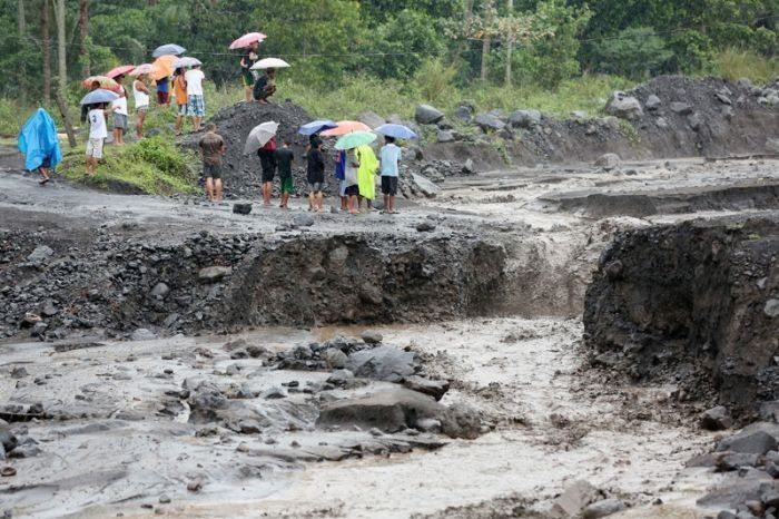
Typhoon Rolly may trigger lahar flows near Mayon, Pinatubo, Taal volcanoes — Phivolcs

MANILA, Philippines — State seismologists on Friday night warned that the heavy rainfall brought by Typhoon Rolly might cause volcanic sediment flows or lahars and muddy runoffs from three volcanoes in Luzon to flow into nearby rivers and drainage areas.
Due to this, the Philippine Institute of Volcanology and Seismology urged the "increased vigilance and readiness of communities" near volcanoes Mayon, Pinatubo, and Taal for lahar and related hazards.
The following channels in Albay province may be affected by lahars and sediment-laden streamflows, according to Phivolcs:
- Miisi
- Binaan
- Anoling
- Quirangay
- Maninila
- Masarawag
- Muladbucad
- Nasisi
- Mabinit
- Matan-ag
- Basud
Meanwhile, the agency said that "Pinatubo lahars are likely be channel-confined and occur on the upper to middle reaches of the Sto. Tomas- Marella and Bucao River systems but may transition to muddy streamflows and floods on the lower reaches."
State seismologists said the following municipalities in Zambales may be affected by lahars from Pinatubo Volcano:
- San Marcelino
- San Narciso
- San Felipe
- Botolan
"Muddy streamflows may likewise be generated along the O’Donnell and Pasig-Potrero River systems draining the Pinatubo edifice to the north and southeast, respectively and affect downstream communities in Tarlac and Pampanga Provinces," the agency added.
Intense rains from "Rolly" may also generate muddy streamflow and muddy runoff around Taal Volcano, Phivolcs said, affecting the following municipalities in Batangas:
- Agoncillo
- Laurel
"DOST-PHIVOLCS strongly advises the communities and local government units of the above identified areas of risk to continually monitor the typhoon conditions and take pre-emptive response measures for their safety from 'ROLLY.'"
The state weather bureau on Saturday morning warned that “Rolly,” the strongest storm of the year thus far, may strengthen into a super typhoon in the next 12 hours. A storm is classified as a super typhoon once its winds reach 220 kilometers per hour.
- Latest
- Trending


