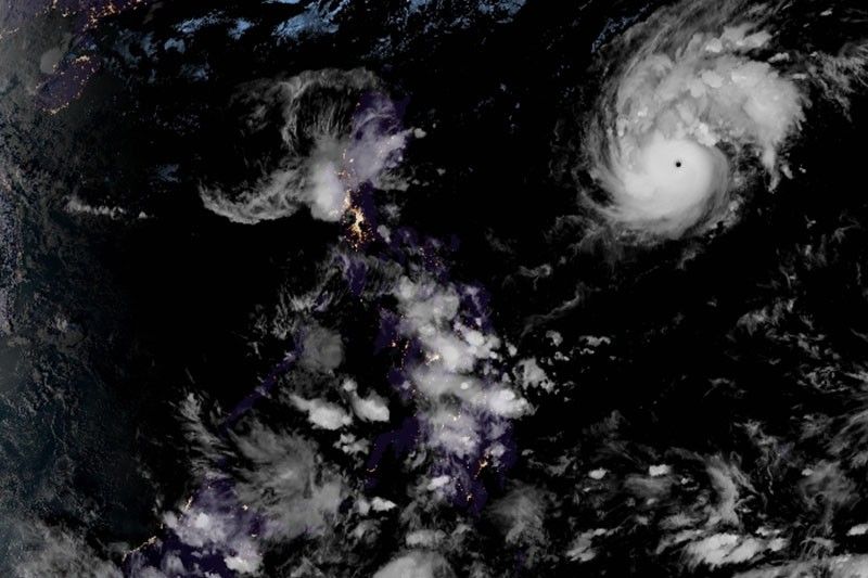
Signal No. 1 up over Catanduanes as Typhoon Rolly intensifies further

MANILA, Philippines — Weather forecasters raised wind signal over Catanduanes Friday afternoon as Typhoon Rolly (international name: Goni) steadily intensifies over the Philippine Sea.
In a bulletin, PAGASA said “Rolly” was last seen 980 kilometers east of Casiguran, Aurora. Moving west at 20 km per hour, it is forecast to make landfall over the Aurora-Quezon area on Sunday evening or Monday early morning.
At the moment, the typhoon packs peak winds of 185 kph from the previous 165 kph and gusts of up to 230 kph from the previous 205 kph. The state weather bureau said it may continuously gain strength while approaching the Philippine landmass and may crash into land with intensity between 175 and 195 kph.
Catanduanes has been placed under TCWS No. 1. Strong breeze to near gale conditions will be experienced in the province within 36 hours. TCWS No. 1 may be also raised over the northern portion of Northern Samar and the rest Bicol region in the next hours.
“Rolly” is threatening the Philippines days after Typhoon Quinta (international name: Molave) smashed through southern Luzon. "Quinta" claimed the lives of 22 people and damaged over 52,000 houses.
‘Don’t underestimate, be prepared’
PAGASA said the highest possible wind signal it could raise would be TCWS No. 4, which is associated with “destructive to very destructive typhoon-force winds.”
Starting Saturday or Sunday, “Rolly” may bring heavy to intense rains over Northern and Central Luzon and Bicol region, particularly those areas along the typhoon’s track.
Ricardo Jalad, executive director of the National Disaster Risk Reduction and Management Council, asked the public to prepare for the impacts of the typhoon and follow orders from their local governments.
“Don’t be complacent. It’s typhoon level. That is very strong,” Jalad said, adding “Rolly” could be likened to Typhoon Tisoy (Kammuri), which battered provinces in Luzon and Visayas in December last year.
“We need to prepare well and follow the orders of local governments. Evacuate early. Fix what needs to be fixed in your houses as soon as possible,” he added.
For now until Saturday morning, the typhoon’s trough or extension and the northeasterly surface windflow will dump light to moderate with at times heavy rains in the following areas:
- Bicol region
- Eastern Visayas
- Central Visayas
- Caraga
- Northern Mindanao
- Zamboanga Peninsula
- Batanes
- Cagayan
- Isabela
PAGASA warned that storm surge of up to two meters may be experienced over the coastal areas of Aurora, Quezon, Marinduque, Bicol region and Northern Samar.
Sea travel, especially for those with small sea vessels, is risky over the seaboards of areas under TCWS and Northern Luzon, the eastern seaboards of Central Luzon and Quezon, and the northern seaboards of Camarines provinces due to rough to very rough seas.
Meanwhile, moderate to rough seas will prevail over the eastern seaboards of Visayas and Mindanao, and the remaining seaboards of Luzon.
PAGASA is also monitoring Tropical Storm Atsani, which is still outside the Philippine Area of Responsibility.
Forecast positions
- Saturday afternoon: 685 km east of Infanta, Quezon
- Sunday afternoon: 55 km north of Daet, Camarines Norte
- Monday afternoon: 260 km west of Dagupan City, Pangasinan
- Tuesday afternoon: 670 km west of Dagupan City, Pangasinan (outside PAR)
- Wednesday afternoon: 900 km west of Central Luzon (outside PAR)
— Gaea Katreena Cabico
- Latest
- Trending


