'Julian' strengthens into severe tropical storm

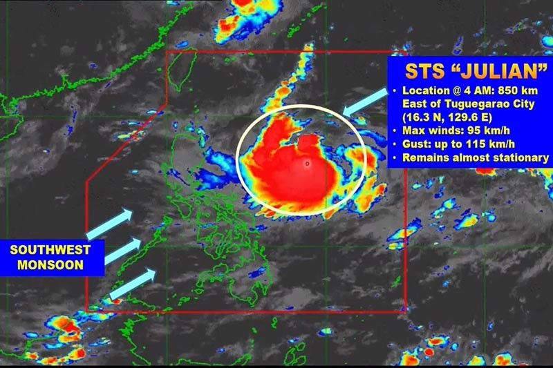
MANILA, Philippines — Tropical cyclone Julian” (international name: Maysak) has intensified from a tropical storm to a severe tropical storm, state weather bureau PAGASA said Saturday morning.
However, it will remain over the Philippine Sea throughout the forecast period, far from the country's landmass, and is expected to exit the Philippine Area Responsibility on Monday evening.
The storm's center was estimated based on all available data 850 kilometers east of Tuguegarao City in Cagayan as of 4:00 a.m. Saturday, moving almost stationary.
It packs maximum sustained winds of 95 kph near the center and gustiness of up to 115 kph.
No tropical cyclone wind signals have been raised and remain unlikely in any part of the country, according to PAGASA.
Although "Julian" is less likely to directly cause high impact weather over the country, weather specialist Benison Estareja said its outer part is affecting the eastern portion of Luzon.
Cloudy skies and rains are forecast in eastern Luzon from Cagayan province down to Bicol Region.
The remainder of Luzon including Metro Manila is expected to experience less cloudiness and chances of rain.
Forecast positions
Sunday morning: 845 km East of Tuguegarao City, Cagayan
Monday morning: 800 km East of Basco, Batanes
Tuesday morning: 795 km Northeast of Extreme Northern Luzon (Outside PAR)
Wednesday morning:1,045 km North Northeast of Extreme Northern Luzon
- Latest
- Trending


