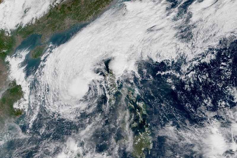
No more areas under storm signals as 'Tisoy' weakens anew before exit

MANILA, Philippines — There are no more areas under tropical cyclone wind signals as the weakening of Severe Tropical Storm Tisoy (Kammuri) continues but there will still be occasional heavy rains over some parts of Luzon.
At 10 a.m., “Tisoy” was located 290 kilometers west southwest of Subic, Zambales.
The typhoon—which thrashed southern Luzon and Eastern Visayas Tuesday with torrential rains and destructive winds—now packs peak winds of 95 kph from the previous 100 kph and gusts of up to 115 kph from the previous 125 kph.
Despite the lifting of storm signals, PAGASA warned that moderate to rough seas may still prevail over the western seaboard of Central Luzon and the southern seaboard of Southern Luzon.
Moderate with occasional heavy rains are also forecast over Ilocos region, Cagayan Valley, Cordillera Administrative Region and Aurora.
Weather forecasters also said the gusty conditions associated with the northeast monsoon or amihan may be experienced in other areas of Northern Luzon, Central Luzon, CALABARZON and MIMAROPA.
Heading west northwest at 15 kph, “Tisoy” is projected to leave the Philippine Area of Responsibility between Wednesday evening and Thursday morning.
It is forecast to weaken further due to the northeast monsoon, which is affecting Luzon.
At least 11 people were reportedly killed in MIMAROPA, Bicol region and Eastern Visayas when “Tisoy” lashed parts Southern Luzon and Eastern Visayas Tuesday.
Its fierce winds and heavy rains toppled trees and power poles, tore roofs and prompted cancelation of hundreds of domestic and international flights.
Forecast positions
- Thursday morning: 615 km west of Subic, Zambales (outside PAR)
- Friday morning: 720 km west of Coron, Palawan (outside PAR)
- Latest
- Trending


