Potential cyclone ‘Quiel’ seen to enter PAR within 24 hours
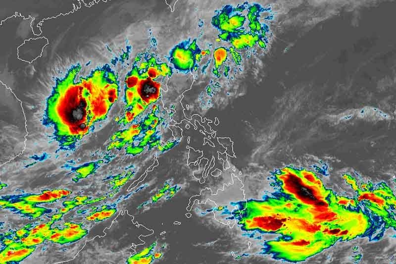
MANILA, Philippines — A low pressure area west of Luzon has developed into a tropical depression and is expected to enter the Philippine area of responsibility within 24 hours.
Weather forecasters said the LPA developed into a tropical depression at 2 a.m.
The weather system was last seen 610 kilometers west southwest of Iba, Zambales with maximum sustained winds of 45 km per hour near the center and gusts of up to 55 kph. It is moving almost stationary.
Once it enters the country’s jurisdiction, the tropical depression will be named “Quiel”—the 17th tropical cyclone this year.
PAGASA said the trough or extension of the tropical depression will bring cloudy skies with scattered rainshowers and thunderstorms over Zambales, Bataan, Occidental Mindoro, Palawan, Cavite and Batangas.
Residents of Ilocos Region, Cordillera Administrative Region and Cagayan Valley will also have cloudy skies with scattered rainshowers and thunderstorms due to a frontal system.
The Intertropical Convergence Zone, meanwhile, will bring cloudy skies with scattered rainshowers and thunderstorms over Caraga and Davao Region.
Metro Manila and the rest of the country will experience partly cloudy to cloudy skies with isolated rainshowers due to localized thunderstorms.
Forecast positions
- Wednesday morning: 445 km west southwest of Iba, Zambales as a tropical storm
- Thursday morning: 385 km west southwest of Iba, Zambales as a tropical storm
- Friday morning: 465 km west southwest of Iba, Zambales as a severe tropical storm
- Saturday morning: 710 km west southwest of Iba, Zambales (outside PAR) as a severe tropical storm
- Sunday morning: 1,095 west of Iba, Zambales (outside PAR) as a severe tropical storm


- Latest
- Trending