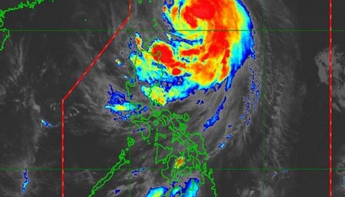
MANILA, Philippines — Severe tropical storm Onyok accelerated as it continued to gather strength over the Philippine Sea yesterday, the state weather bureau said.
As of 5 p.m. yesterday, tropical cyclone wind signal no. 1 remained hoisted over Batanes and Babuyan Islands, according to the Philippine Atmospheric, Geophysical and Astronomical Services Administration (PAGASA).
PAGASA weather forecaster Raymond Ordinario said Onyok was not expected to make landfall but its center or eye will have passed near Batanes this morning, bringing rains and gusty winds. It was forecast to be at 195 kilometers northeast of Basco, Batanes this morning.
The trough or extension of Onyok will also continue to bring scattered light to moderate rains and thunderstorms over Cagayan Valley, Apayao, and Ilocos Norte until this afternoon.
The storm is expected to exit the Philippine area of responsibility this evening. Onyok is the 15th cyclone to enter the country this year and the fifth this month.
Metro Manila and the rest of the country will continue to experience partly cloudy to cloudy skies with isolated rains due to thunderstorms.


