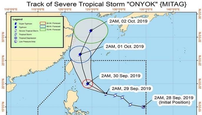
MANILA, Philippines — Tropical Storm “Onyok” (International Name: Mitag) developed into a severe tropical storm at 2 a.m., PAGASA said in a weather bulletin issued early Sunday.
At 4 a.m., the center of "Onyok," which entered the Philippine area of responsibility on Saturday, was located at 605 kilometers east of Tuguegarao City, Cagayan.
PAGASA weather forecaster Raymond Ordinario said "Onyok" packs maximum sustained winds of up to to 95 km per hour near the center and gustiness of up to 115 kph.
Two areas were placed under Tropical Cyclone Wind Signal No. 1. These are Batanes and Babuyan Islands.
The severe tropical storm is currently moving west at 30 kph.
Ordinario, however, said "Onyok" is less likely to make landfall in the country but it is expected to strengthen into a typhoon within 24 hours.
PAGASA added that it is possible to raise Tropical Cyclone Wind Signal No. 2 over Batanes area.
The weather agency said the trough or extension of "Onyok" would bring scattered light to moderate rain showers and thunderstorms over Cagayan Valley and Bicol Region.
It also warned the public that sea travel is risky over the northern and eastern seaboards of Northern Luzon, especially for small seacrafts. Sea travel is also risky over Batanes and Babuyan Islands due to potentially rough sea conditions.
"Onyok" is expected to leave PAR by Tuesday morning. — Rosette Adel


