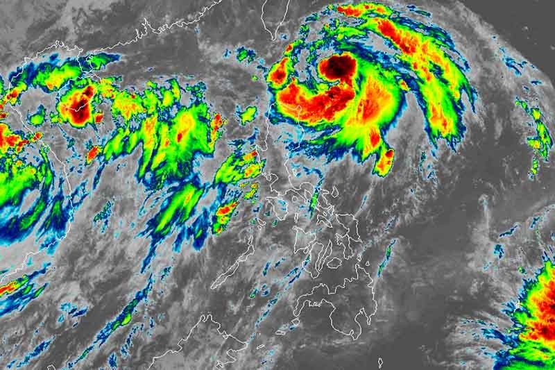
‘Liwayway’ to exit PAR as early as Wednesday evening

MANILA, Philippines — Tropical Storm Liwayway (Lingling) is seen to leave the Philippine Area of Responsibility between Wednesday evening and early Thursday morning, weather forecasters said Tuesday.
The center of “Liwayway” was last spotted 255 kilometers east of Calayan, Cagayan.
The tropical storm slightly intensified: its maximum sustained winds now at 85 km per hour from the previous 75 kph and its gusts now at 105 kph from the previous 90 kph. It is moving north northwest at 20 kph.
Tropical Cyclone Wind Signal No. 1 remains hoisted over Batanes. Residents of the province may experience winds of 30 and 60 kph or intermittent rains within 36 hours.
Between Tuesday and Wednesday morning, “Liwayway” will bring light to moderate with intermittent heavy rains over Apayao, Cagayan (including Babuyan Islands) and Batanes.
Meanwhile, residents of Ilocos region, Central Luzon, Metro Manila, CALABARZON, MIMAROPA, Panay Island, Guimaras and the rest of Cordillera Administrative Region will experience scattered light to moderate rains with at times heavy rains.
Sea travel remains risky over the seaboards of Luzon due to potentially rough sea conditions.
“Liwayway” remains less likely to make landfall in the country but it is seen to strengthen into a severe tropical storm within 24 hours.
Forecast position
- Wednesday morning: 270 km northeast of Basco, Batanes
- Thursday morning: 555 km north northeast of Basco, Batanes
- Friday morning: 935 km north northeast of Basco, Batanes (outside PAR)
— Gaea Katreena Cabico
- Latest
- Trending


