'Kabayan’ on its way out of PAR, potential 'Liwayway' brewing

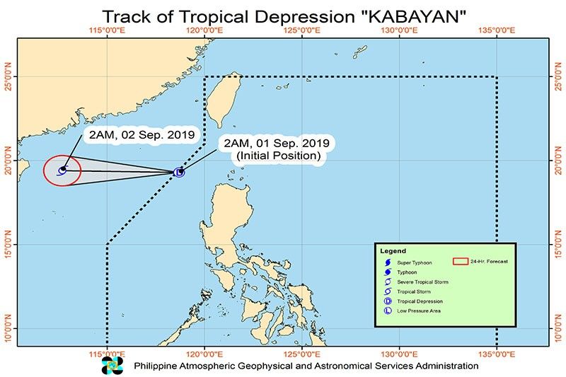
MANILA, Philippines — The low pressure area located west of Calayan, Cagayan that developed into Tropical Depression Kabayan on Sunday would exit the Philippine area of responsibility this morning, PAGASA said in its forecast.
At 4 a.m., the eye of "Kabayan" was located at 310 kilometers west of Calayan, Cagayan. It packs maximum sustained winds of up to 55 km per hour near the center and gustiness of up to 70 kph.
"Kabayan" is moving west at 20 kph. It is projected to be located 920 km west of Calayan, Cagayan, outside PAR, on Monday morning.
The state weather bureau added that "Kabayan" is forecast to intensify into a tropical storm while moving westward towards the southern China-northern Vietnam area.
PAGASA furthered that it is still monitoring another LPA located at 515 km east of Hinatuan, Surigao del Sur on Sunday morning.
“It is forecast to develop into Tropical Depression 'Liwayway' within 48 hours,” the weather agency said.
Meanwhile, some parts of the country will experience scattered light to moderate rains with occasional heavy rain showers due to the southwest monsoon. These rains will be experienced over Ilocos Region, Zambales, Bataan, Metro Manila, Calabarzon, Mimaropa and Western Visayas.
PAGASA advised small seacraft not to sail over the northern and western seaboards of northern Luzon and the western seaboard of central Luzon due to potentially rough sea conditions. — Rosette Adel
- Latest
- Trending


