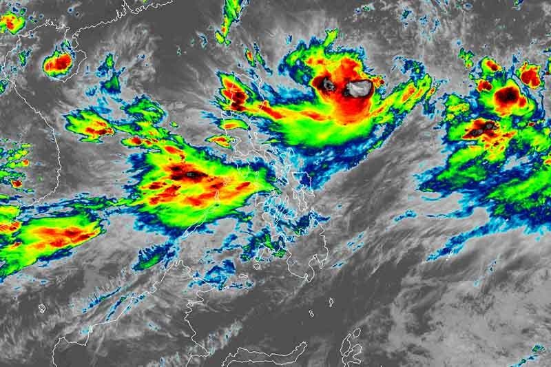
Aside from ‘Hanna,’ PAGASA monitoring 3 more weather systems

MANILA, Philippines — Forecasters from state weather bureau PAGASA are monitoring Tropical Storm Hanna (international name: Lekima) and three other weather systems.
In a briefing late Monday afternoon, weather specialist Aldczar Aurelio said “Hanna”—heading west-northwest at 10 kilometers per hour—was last seen 845 km east of Aparri, Cagayan.
It packs maximum sustained winds of up to 85 kph and gusts of up to 105 kph.
“Hanna” is expected to develop into a severe tropical storm on Tuesday afternoon. By Wednesday, it is seen to intensify into a typhoon and will remain under such category until it leaves the Philippine area of responsibility on Friday.
It is not expected to make any landfall.
Aurelio said the southwest monsoon or habagat is affecting Luzon and the Visayas.
Residents of Palawan—including Calamian and Cuyo islands—Mindoro provinces, Romblon and Western Visayas will experience moderate to heavy monsoon rains until Tuesday.
Meanwhile, cloudy skies with scattered rainshowers and thunderstorms will affect Metro Manila, Central Luzon, Calabarzon, Bicol, the rest of Mimaropa and the Visayas.
Other weather systems
PAGASA is also monitoring a low pressure area 2,440 km east northeast of Southern Luzon—outside PAR.
The LPA is expected to develop into a tropical depression within 24 hours but it has a slim chance of entering the country’s jurisdiction.
A shallow LPA 395 km west of Iba, Zambales is also being monitored by the weather bureau.
Aurelio said it is not seen to become a tropical cyclone. He added the weather disturbance may be sucked by “Hanna” once it approaches the tropical storm.
PAGASA also spotted a typhoon with the international name of “Francisco.” Typhoon Francisco was located outside PAR and is not forecast to enter the country’s jurisdiction. — Gaea Katreena Cabico
- Latest
- Trending


