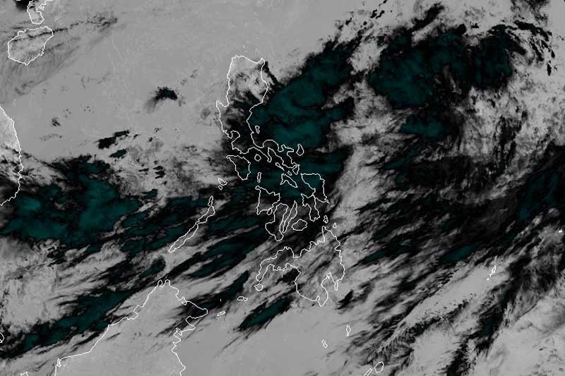
'Falcon' seen to develop into tropical storm on Wednesday

MANILA, Philippines — Tropical Depression Falcon is expected to intensify into a tropical storm by Wednesday, weather forecasters said Monday.
In a press briefing late Monday morning, state weather bureau PAGASA said 'Falcon' may develop into a tropical storm before approaching or making landfall over the northernmost parts of Luzon on Wednesday afternoon or evening.
PAGASA may also raise tropical cyclone wind signal over parts of northern Luzon as early as Tuesday morning.
'Falcon' was last seen 940 kilometers east northeast of Virac, Catanduanes or 1,150 km east of Casiguran, Aurora. It is moving north northwest at a faster pace at 25 km per hour.
The tropical depression maintained its maximum winds of up to 45 kph and gusts of up to 60 kph.
No tropical cyclone wind signal has been hoisted yet since 'Falcon' remains far from land.
Residents of the Bicol region and Eastern Visayas will experience scattered to widespread rainshowers and thunderstorms due to the trough or extension of the tropical depression and over Zamboanga peninsula, Bangsamoro, MIMAROPA and the rest of the Visayas due to the southwest monsoon or habagat.
By Tuesday, light to moderate with occasional heavy monsoon rains will affect MIMAROPA, Western Visayas, Zamboanga Peninsula and the Bangsamoro Autonomous Region in Muslim Mindanao.
Moderate to heavy rains will prevail over Ilocos region, Cordillera Administrative Region, Cagayan Valley and the provinces of Zambales, Bataan and Mindoro due to the combined effects of 'Falcon' and the southwest monsoon on Wednesday.
Residents of Metro Manila, CALABARZON, Western Visayas and the rest of Central Luzon and MIMAROPA will experience light to moderate with occasional heavy monsoon rains on Wednesday.
'Falcon' is expected to exit the Philippine area of responsibility on Thursday morning.
Angat Dam
Weather forecasters also said Angat Dam needs at least 350 millimeters of rainfall to reach its 180-meter operating level. This amount of rainfall should shower the Angat watershed in one event to improve the reservoir’s water level considerably.
As of early Monday morning, the water elevation at Angat Dam was at 158.75 meters—1.25 meters below the 160-meter critical level.
"The cloud bonds of the tropical depression won’t directly hit [Angat Dam] but we are expecting the southwest monsoon will be enhanced. Hopefully, it will bring rains over the watershed of Angat," Esperanza Cayanan, PAGASA weather division chief, said in a mix of English and Filipino.
She added: "Falcon [will be inside PAR] only until Wednesday. It’s not that slow to bring enough rains but definitely there will be rains and thunderstorm activity over Angat watershed."
Forecast positions
- Tuesday morning: 585 km east of Casiguran, Aurora
- Wednesday morning: 210 km east of Tuguegarao City, Cagayan
- Thursday morning: 180 km west northwest of Calayan, Cagayan
- Friday morning: 565 km northwest of Basco, Batanes (outside PAR)
- Saturday morning: 950 km northwest of Basco, Batanes (outside PAR)
— Gaea Katreena Cabico
- Latest
- Trending


