‘Samuel’ speeds up slightly as it moves closer to land

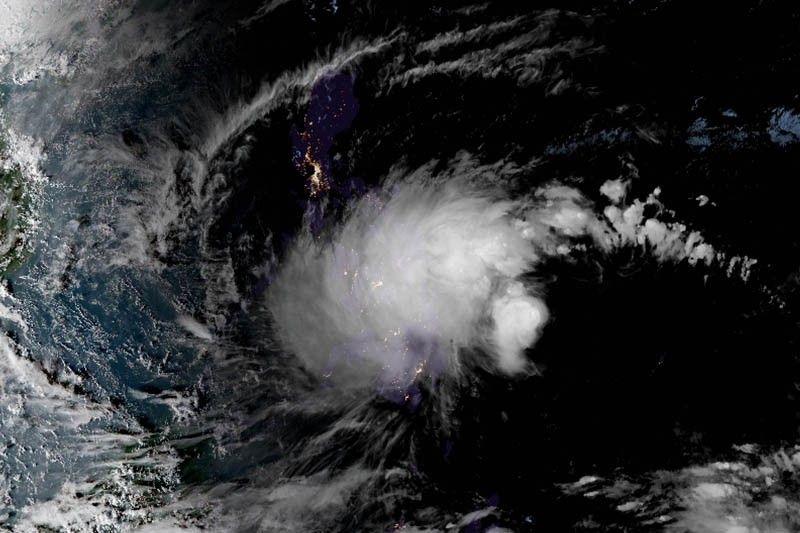
MANILA, Philippines — Tropical depression Samuel has accelerated slightly while traversing the Philippine Sea, state weather bureau PAGASA said Monday afternoon.
As of 4 p.m., Samuel was seen 505 kilometers east of Hinatuan, Surigao del Sur with maximum sustained winds of 55 kph near the center and gusts of up to 65 kph.
The tropical depression slightly gained speed, now moving northwest at 25 kph from the previous 15 kph.
Samuel is forecast to make landfall over the Eastern Visayas-Caraga area on Tuesday afternoon or evening.
PAGASA has placed 18 areas under Signal No.1:
- Masbate
- Samar
- Eastern Samar
- Biliran
- Leyte
- Southern Leyte
- Bohol
- Cebu
- Siquijor
- Negros Oriental
- Negros Occidental
- Surigao del Norte
- Surigao del Sur
- Agusan del Norte
- Agusan del Sur
- Dinagat Islands
- Misamis Oriental
- Camiguin
Moderate to heavy rains which may trigger flooding and landslides are expected over CARAGA region, Eastern Visayas, Central Visayas, and the provinces of Negros Occidental, Davao Oriental, Compostela Valley, Bukidnon, Misamis Oriental and Camiguin.
The state weather bureau also said it might place northern Samar, Capiz, Iloilo and Guimaras under Signal No. 1 in the next severe weather bulletin to be issued at 11 p.m. today.
PAGASA advised fishermen and those with small seacrafts not to venture over the areas under Signal No. 1 and the eastern seaboards of Mindanao.
Forecast positions
- Tuesday afternoon: 195 km east of Maasin City, Southern Leyte
- Wednesday afternoon: 65 km east southest of Cuyo, Palawan
- Thursday afternoon: 340 km northwest of Puerto Princesa City, Palawan
- Friday afternoom: 745 km west northwest of Puerto Princesa City, Palawan
— Gaea Katreena Cabico
- Latest
- Trending


