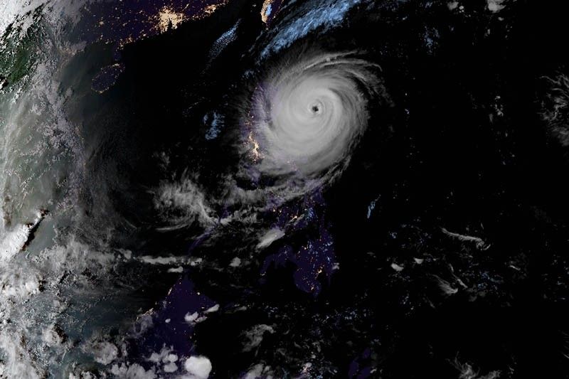
More areas under Signal No. 3 as ‘Rosita’ nears landfall

MANILA, Philippines — Signal No. 3 has been raised over Nueva Vizcaya and Ifugao as Typhoon Rosita (international name: Yutu) slowed down Monday afternoon.
Previously, state weather bureau PAGASA placed Isabela, Quirino and northern Aurora under Signal No. 3. Residents of these areas may expect winds of greater than 121 kilometers per hour up to 170 kph in at least 18 hours.
Rosita is forecast to make landfall over the southern Isabela and northern Aurora area Tuesday morning. It will traverse the provinces of Aurora, Isabela, Quirino, Ifugao, Nueva Vizcaya, Benguet and La Union.
The typhoon will bring heavy to moderate rains over northern and central Luzon starting Monday evening.
PAGASA also raised tropical cyclone warning signals in the following areas:
Signal No. 2 (winds of 61 to 120 kph expected in at least 24 hours)
- Cagayan
- Ilocos Norte
- Apayao
- Abra
- Kalinga
- Ilocos Sur
- Mountain Province
- La Union
- Benguet
- Pangasinan
- Tarlac
- Nueva Ecija
- Northern Quezon including Polillo Island
- Southern Aurora
- Zambales
- Pampanga
- Bulacan
Signal No. 1 (winds of 30 to 60 kph expected in at least 24 hours)
- Southern Quezon
- Batanes and Babuyan group of islands
- Rizal
- Metro Manila
- Laguna
- Batangas
- Bataan
- Cavite
- Camarines Norte
The state weather bureau said that residents of areas under Signal Nos. 2 and 3 will experience stormy weather; hence, travel by land is dangerous in these areas.
Storm surge of up to three meters is also possible over the coastal areas of Isabela, Cagayan, Aurora, Ilocos Sur, Ilocos Norte and La Union.
Rosita—the 18th tropical cyclone this year and the second this month—may possibly exit the Philippine landmass by Tuesday afternoon. It is expected to exit the Philippine area of responsibility by Wednesday evening.
As of 4 p.m., Rosita was seen 310 km east northeast of Casiguran, Aurora with maximum sustained winds of 150 kph near the center and gusts of up to 185 kph.
It slightly slowed down, now moving west at 15 kph from the previous 20 kph.
Preparations underway
According to a flash update by the United Nations Office for the Coordination of Humanitarian Affairs, local government units have been leading the preemptive evacuation of communities in northern Luzon that are at risk from the typhoon.
"The National Disaster Risk Reduction and Management Council has met daily in its Pre-Disaster Risk Assessment forum and is continuing to disseminate public information alerts," it also said.
No update from the NDRRMC was available as of this post.
"The Department of Social Welfare and Development has prepositioned stocks at the regional level and set up emergency telecommunications. DSWD has over P465 million in standby funds and over 370,000 food packs pre-positioned in its national and regional warehouses," UN OCHA also said.
"The Armed Forces of the Philippines disaster response units are on-call and will deploy communication teams at the municipal level to augment the capacity of local government units. Military assets will also be mobilized to transport relief items and clear roads as needed," it said.
Forecast positions
- Tuesday morning: 50 km north of Dagupan City, Pangasinan
- Wednesday afternoon: 305 km west of Sinait, Ilocos Sur
- Thursday afternoon: 495 km west northwest of Sinait, Ilocos Sur (outside PAR)
- Friday afternoon: 590 km west northwest of Laoag City, Ilocos Norte (outside PAR)
- Saturday afternoon: 655 km west northwest of Laoag City, Ilocos Norte (outside PAR)
- Latest
- Trending


