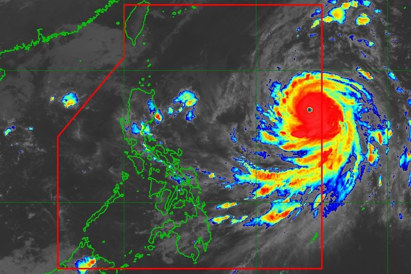
Typhoon Queenie gathers strength, enters Philippines

MANILA, Philippines — Typhoon Queenie (international name Kong-Rey) entered the Philippine area of responsibility yesterday and is expected to bring rains over northern Luzon areas until Thursday, the state weather bureau said.
The typhoon, however, remains unlikely to make landfall in any part of the country, the Philippine Atmospheric, Geophysical and Astronomical Services Administration (PAGASA) added.
As of 4 p.m. yesterday, the eye of Queenie was spotted at 1,170 kilometers east northeast of Borongan City, Eastern Samar. It packed winds of 160 kilometers per hour near the center and gustiness of up to 195 kph.
It is forecast to move west northwest at 15 kph.
PAGASA said Queenie is likely to intensify further while inside the Philippines and is expected to slightly change course from west northwest to northwest towards southern Japan.
It added that the typhoon would bring light to at times moderate rains over Benguet, Nueva Vizcaya, Quirino and Aurora provinces until Thursday.
Queenie is also expected to cause very rough seas in northern Luzon, the area devastated by the powerful Typhoon Ompong last month.
It is forecast to exit the country on Friday.
Metro Manila and the rest of the country will continue to experience isolated rains due to thunderstorms.
PAGASA warned against possible flash floods and landslides during severe thunderstorms.
Weather specialist Ariel Rojas said two to three tropical cyclones normally enter the Philippines in October and that most of these will cross Luzon.
- Latest
- Trending


