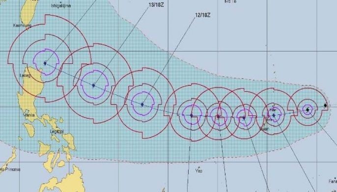
Typhoon Mangkhut to enter PAR Wednesday
MANILA, Philippines — Typhoon Mangkhut (international name) may enter the Philippine area of responsibility by Wednesday, state weather bureau PAGASA said Monday.
The tropical storm, which is forecasted to develop into a super typhoon, will be called "Neneng" once it enters the country.
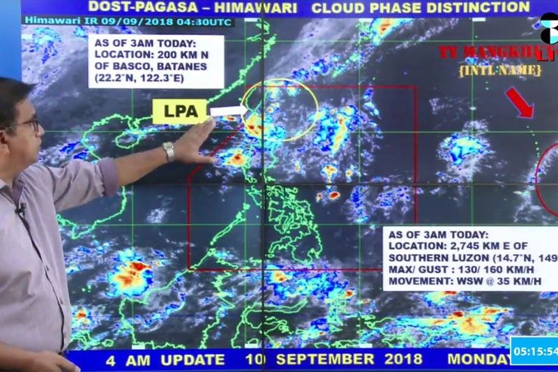
At 3 a.m., "Mangkhut" was located 2,745 kilometers east of southern Luzon with maximum sustained winds of 130 kilometers per hour and gusts of up to 160 kph.
The weather disturbance is moving west northwest at 35 kph.
As of the moment, the typhoon will not have any direct effect to the country as it is still outside PAR, weather specialist Melo Mendoza said in a press briefing.
The typhoon, however, may reach a peak intensity of greater than 205 kph before entering the Philippines.
"Mangkhut" is expected to pass over the Cagayan-Batanes area around Saturday and exit PAR between Saturday and Sunday.
The state weather bureau is also monitoring a low pressure area inside PAR, which was last located 200 kilometers north of Basco, Batanes.
PAGASA senior weather forecaster Gener Quitlong earlier warned that Mangkhut may reach the strength of Typhoon Jebi (local name Maymay), which devastated Japan last week. — Patricia Lourdes Viray


- Latest
- Trending