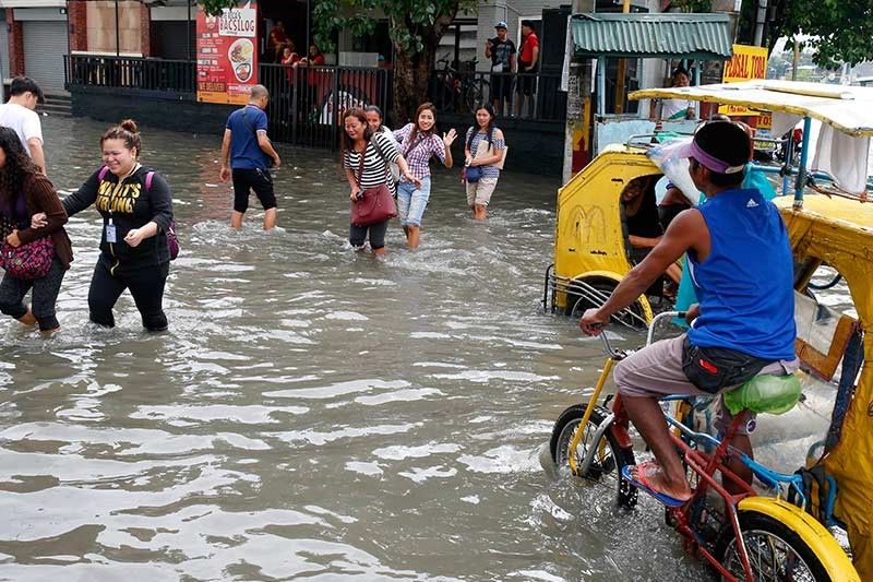
'Josie' may intensify into tropical storm on Sunday; monsoon rains threaten SONA

MANILA, Philippines (Updated 11:44 a.m.) — PAGASA said Tropical Depression Josie is expected to strengthen into a tropical storm on Sunday afternoon or Monday as it warned of possible unrelenting monsoon rains on the day of President Rodrigo Duterte's third State of the Nation Address.
"Inaasahan po natin na makakaranas po tayo ng maulap na kalangitan na may kalatkalat na pag-ulan at pagkulog [the whole day]... Dala pa rin ito ng habagat natin," PAGASA weather forecaster Ezra Bulquerin said in an interview over DzMM early Sunday.
"Josie" is expected to exit the Philippine area of responsibility on Monday afternoon or evening, Bulquerin added.
In its 11 a.m. severe weather bulletin, PAGASA said "Josie" was spotted over the Bashi Channel.
At 10 a.m. today, the center of the tropical depression was estimated at 170 km northeast of Basco, Batanes.
Signal No. 1 is still hoisted over Batanes and the Babuyan Group of Islands while the tropical cyclone signal warning over northern Cagayan was lifted at 8 a.m. Sunday.
"Josie" has maintained strength packing maximum sustained winds of 60 kph near the center and gustiness of up to 75 kph.
It is moving north-northeast at 25 kph.
The state weather bureau said scattered to widespread monsoon rains are expected today over Metro Manila, Central Luzon, Ilocos Region, Cordillera Administrative Region, rest of Cagayan Valley, Western Visayas, Cavite, Batangas, Rizal, Laguna, Mindoro Provinces and Northern Palawan including Calamian Group of Islands.
"Residents of these areas, especially those living near river channels, in low-lying and in mountainous areas are advised to take appropriate actions against possible flooding and landslide, coordinate with local disaster risk reduction and management offices and continue monitoring for updates," PAGASA said.
It added that sea travel remains risky over the seaboards of northern Luzon and the western seaboard of central Luzon, especially in areas under Signal No. 1.
The low pressure area monitored west of Ilocos Sur has developed into a tropical depression Saturday morning, PAGASA says.
The tropical depression has been named "Josie." This is the tenth tropical cyclone in 2018.
It packs maximum sustained winds of 55 kilometers per hour and gustiness of up to 65 kilometers per hour. “Josie” comes a day after Severe Tropical Storm Inday left the Philippine Area of Responsibility.
Tropical Cyclone Warning Signal No. 1 has been raised over Batanes, Northern Cagayan including Babuyan Group of Islands, Ilocos Norte, northern portion of Ilocos Sur, Apayao and northern portion of Abra.
Tropical Depression Josie is now outside the Philippine Area of Responsibility.
It has maximum sustained winds of 55 kilometers per hour near the center and gustiness of up to 65 kph, moving north at 20 kph.
The southwest monsoon or habagat will continue to bring monsoon rains over parts of Luzon and the Visayas.
PAGASA has lifted all tropical cyclone warning signals.
Tropical Depression Josie continues to move north-northeastward over the Philippine Sea.
PAGASA has lifted all tropical cyclone warning signals.
Tropical Depression Josie continues to move north-northeastward over the Philippine Sea.
Cavite Gov. Jesus Crispin Remulla places the whole province of Cavite under state of calamity.
Earlier, Marikina City and Balanga City and Dinalupihan in Bataan were also placed under the state of calamity.
This is due to the bad weather brought about by Tropical Depression Josie.
"Josie" is expected to leave the Philippine area of responsibility between Sunday night and Monday morning.
Marikina Mayor Marcelino Teodoro announces that the city is placed under state of calamity.
- Latest
- Trending


