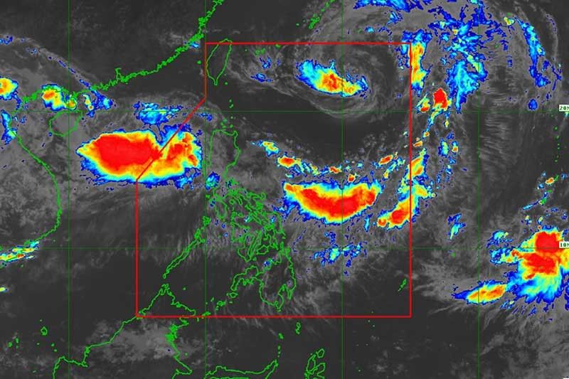
‘Inday’ strengthens into severe tropical storm as it gears to exit Philippines

MANILA, Philippines — “Inday” has intensified into a severe tropical storm Friday morning as it continued to make its way out of the Philippine Area of Responsibility, state weather bureau PAGASA said.
The severe tropical storm will likely leave PAR between Friday night and Saturday morning.
In its 11 a.m. bulletin, PAGASA said “Inday” was last seen 925 kilometers east northeast of Basco, Batanes.
It strengthened with maximum sustained winds of 90 kilometers per hour near the center and gustiness of up to 115 kilometers per hour. “Inday” is heading northwestward at 25 kilometers per hour.
The state weather bureau said it also monitoring a low pressure area outside PAR. The weather disturbance, located 475 kilometers west of Laoag City, Ilocos Norte, is expected to enter PAR over the weekend.
“Inday” and the LPA will enhance the southwest monsoon or habagat. Intermittent moderate to heavy monsoon rains will persist over Ilocos region, Cordillera Administartive Region, Zambales, Bataan, Pampanga, Bulacan, Tarlac and Nueva Ecija.
Scattered light to moderate with occasional heavy rains, meanwhile, will affect Metro Manila and the rest of Luzon.
“Sea travel remains risky over the western seaboard of Central Luzon due to the southwest monsoon,” PAGASA warned.
Forecast positions:
- Saturday morning: 890 kilometers northeast of Basco, Batanes
- Sunday morning: 1,075 kilometers north of Basco, Batanes
- Monday morning 1,435 kilometers north northeast of Basco, Batanes
- Latest
- Trending


