Destruction of Scarborough Shoal seen on Google Earth

MANILA, Philippines — Anybody can confirm the destruction of Panatag or Scarborough Shoal as satellite image of the traditional fishing ground off the coast of Zambales can be searched online.
These photos can be seen on Google Earth, a software that renders a 3D representation of Earth based on satellite imagery.
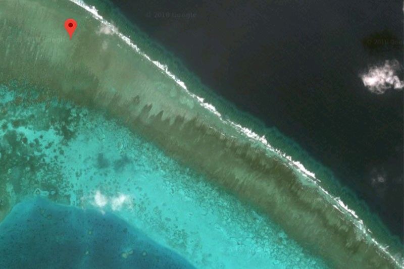
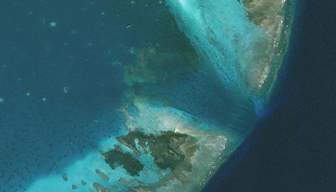
Jay Batongbacal, director of the University of the Philippines Institute for Maritime Affairs and Law of the Sea, posted photos comparing the situation of the shoal in 2009, 2014 and 2016.
"The destruction of Scarborough Shoal reported by [Philippine] fishermen from Pangasinan and Zambales these past few days can be easily using GoogleEarth," Batongbacal said on Facebook.
In the first photo dated May 2009, coral reef is visibly "pristine and undisturbed" as this was the time when Filipino fishermen were free to access the area.
This was way before the standoff between the Philippine Navy and Chinese Coast Guard on Scarborough Shoal in 2012.
The second photo dated April 2014 shows the damage on the reef that Chinese boats left after using their propellers to harvest giant clams. This was two years after China effectively took control of the area.
"Considerable scarring and reef damage visible, all inflicted after China took control of the reef, kept all other boats from entering the shoal, and allowed only Chinese fishing boats to operate in the area," Batongbacal captioned the second photo.
The third photo dated September 2016 indicate compelete destruction of the 300-square meter once pristine reef, which Batongbacal described as "lifeless rubble" under the Chinese Coast Guard's watch.
This was a few months after the Permanent Court of Arbitration issued a landmark ruling invalidating Beijing's nine-dash line claim over the South China Sea.
Citing Washington-based think tank Asia Maritime Transparency Initiative, Batongbacal noted that roughly half of the total reef area of Scarborough Shoal have been destroyed.
"Despite the resumption of PH fishing outside the shoal, as late as summer 2017, media reporters accompanying PH a maritime air patrol snapped photos of Chinese boats continuing to carry out this activity. Recent complaints by fishermen raised in the forums yesterday indicate that they continue to this day, although is smaller numbers," Batongbacal said.
Acting Chief Justice Antonio Carpio, part of the country's legal team in the arbitration against China, had urged the Philippine government to file a new case seeking for compensation following Chinese fishermen's destruction of coral reefs in Scarborough Shoal.
Carpio pointed out that Beijing violated its commitment under the United Nations Convention on the Law of the Sea to protect and preserve marine environment in the area.
"This time the Philippines should demand damages for the economic losses of Filipino fishermen," Carpio said earlier this week.
The Philippine government, on the other hand, is keen on resolving issues with China bilaterally.
"Filing a new case against China will reverse our diplomatic gains, not to mention the cost it entails. We can therefore discuss the issue of destroyed coral reefs in Scarborough Shoal as this forms part of the area of maritime environmental protection instead of filing a new case," presidential spokesperson Harry Roque said.
- Latest
- Trending


