Typhoon Nina makes landfall over Catanduanes

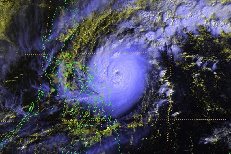
Position of Typhoon Nina (international name Nock-Ten) as of 11:30 a.m. is seen in this satellite image from the US Navy's Joint Typhoon Warning Center on Sunday, Dec. 25, 2016. JTWC
MANILA, Philippines (7th update; First published 7:02 a.m.) — Powerful Typhoon Nina made landfall over Catanduanes on Sunday evening as thousands of families in high-risk areas were evacuated on Christmas Day.
In a 7 p.m. alert, state weather bureau PAGASA said Nina (international name Nock) made made landfall over Bato town at 6:30 p.m. The typhoon maintained its strength in the past hours, endangering the province of Catanduanes.
PAGASA hoisted a cyclone warning Signal No. 4 over Camarines Sur and Catanduanes.

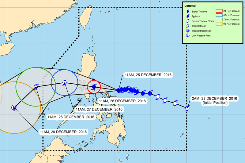
PAGASA forecast track of Typhoon Nina as of 2 p.m. on Sunday, Dec. 25, 2016
LIVE UPDATES: Typhoon Nina
The US military's Joint Typhoon Warning Center said Nina is a super typhoon with winds of up to 250 kph (135 knots) and gusts of up to 305 kph (164 knots) as of Christmas morning (Manila time).
PAGASA, meanwhile, said Nina has maximum sustained winds of 185 kph near the center and gustiness of up to 255 kph.
As of 4 p.m., the eye of the typhoon was located at 65 kilometers east southeast of Virac, Catanduanes.
On Monday morning, Nina is expected to be in the vicinity of Gumaca, Quezon, while on Tuesday, it is likely to be at 235 kilometers west southwest of Iba, Zambales.
The slow-moving cyclone, moving west at 15 kph, is expected to leave the Philippine area of responsibility on Thursday morning at 340 kilometers west of Pagasa Island off Palawan.
PAGASA warned those near coastal areas especially in Albay, Sorsogon, Camarines Sur, Camarines Norte and Catanduanes that Nina would bring storm surge as high as 2.5 meters (8 feet or as high as a one storey building) in parts of the country, along with heavy rains and flooding. Storm surges are a rush of water from the sea into land.
- Latest
- Trending


