Karen barrels toward Luzon; storm surge warning up; several areas under Signal 3

MANILA, Philippines – State weather forecasters have warned residents in the path of Typhoon Karen that it may be the most damaging so far this year as the storm is expected to barrel through populous provinces in Central Luzon today.
The Philippine Atmospheric, Geophysical and Astronomical Services Administration (PAGASA) has raised storm surge warnings in coastal areas in the path of Typhoon Karen, which is forecast to make landfall in the Quezon-Aurora area this morning.
Over 30 provinces in Luzon were placed under cyclone warning signals yesterday as Karen inched closer to Philippine landmass, based on the 5 p.m. bulletin issued by PAGASA.
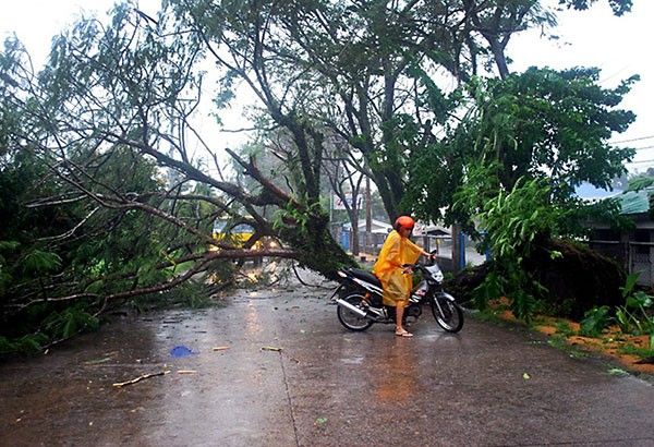
Karen (international name Sarika) has knocked down power and telephone lines in Catanduanes, the Office of Civil Defense (OCD) said.
While the storm is not the most powerful to hit the country this year, it could cause the most damage as it will cross heavily populated areas north of Metro Manila, PAGASA weather forecaster Benison Estareja said.
“We can see from the radar that the storm is very destructive. It can destroy wooden houses, it can topple trees. It can possibly rip off roofs,” Estareja said.
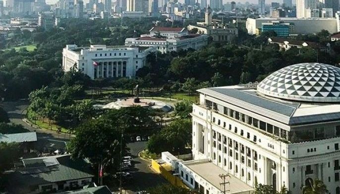
“This one will have an impact because most of the people are in (that part of) Luzon. Even Metropolitan Manila will be affected,” he warned.
Although Karen did not directly hit the eastern region of Bicol, that area experienced heavy rains as it passed nearby yesterday, OCD spokesperson Rachel Miranda said.
The typhoon left the more than 246,000 residents of Catanduanes without electricity and telephone service, she said.
More than 400 people were evacuated from their homes and sea and air travel in these areas has been suspended as a safety precaution, officials said.
Disaster officials made no initial reports of any casualty or injuries.
Malacañang, however, advised the public to stay clear of danger areas.
“We’d just like to encourage our countrymen, especially those in Luzon, to take precautions, and then really look out because the upcoming typhoon will make landfall sometime (this) morning,” presidential spokesman Ernesto Abella said.
“I repeat, we are urging the public to be prepared for the landfall of Karen, the 11th typhoon to enter the country this year. So let us stay away from danger areas… this Karen is expected to be elevated to severe tropical storm within the next 24 hours. Metro Manila is expected to experience heavy rains,” he said.
Abella said President Duterte has ordered the National Disaster Risk Reduction and Management Council and the Department of Social Welfare and Development (DSWD) to be ready and monitor the possible evacuation of residents in the affected areas.
Catanduanes was earlier placed under Signal No. 3 but as Karen moved closer to Luzon, the storm signals were also raised in several other provinces, including Pangasinan, northern Zambales, Tarlac, Nueva Ecija, Aurora, northern Quezon including Polillo Island, La Union, Benguet, Nueva Vizcaya and Quirino.
Under Signal No. 2 are the provinces of Ilocos Sur, southern Isabela, Mountain Province, Ifugao, the rest of Zambales, Pampanga, Bulacan, Bataan, Rizal, the rest of Quezon, Camarines Norte, Catanduanes and Metro Manila.
PAGASA placed Ilocos Norte, Abra, Kalinga, the rest of Isabela, Southern Apayao, Southern Cagayan, Oriental Mindoro, Cavite, Batangas, Laguna, Marinduque, Camarines Sur and Albay including Burias Island under Signal No. 1.
As of 4 p.m. yesterday, Karen was estimated to be at 205 km east of Infanta, Quezon.
It packs maximum sustained winds of up to 130 kilometers per hour near the center and gustiness of up to 180 kph.
The typhoon is forecast to move west-northwest at a speed of 22 kph, with state weather forecasters saying it would make landfall in Aurora province early today.
PAGASA said the typhoon will be at the vicinity of Cabanatuan City in Nueva Ecija before noon and will barrel through central and northern Luzon before exiting the Philippine area of responsibility tomorrow.
“Estimated rainfall amount is from moderate to heavy within the 500-km diameter of the typhoon,” said the weather bureau. “Fisherfolk and those with small seacraft are advised not to venture out to the open sea.”
Warnings and precautions
PAGASA said storm surges are possible in coastal areas placed under Signal Nos. 2 and 3.
The weather bureau said wave height in the open sea may reach 14 meters.
It also warned of heavy damage to high-risk structures and cautioned residents against possible flashfloods and landslides.
A red rainfall warning level was also issued in Albay, Catanduanes and Camarines Norte yesterday afternoon, with the weather bureau saying flooding and landslides are expected to occur.
Moderate to heavy rainfall was also experienced in Camarines Sur, Sorsogon, Masbate, Marinduque, Romblon and Northern Samar.
Light to moderate rainfall was experienced in Mindanao due to the effects of the typhoon.
Airline firms PAL Express and Cebu Pacific cancelled their domestic flights to the Bicol region and to the south due to the approaching storm.
Cebu Pacific also cancelled 14 international flights from Clark in Pampanga going to Hong Kong, Guam, Bangkok, Singapore and to Narita in Japan.
The Philippine Coast Guard (PCG), on the other hand, has prohibited sea vessels from sailing until PAGASA lifts all storm warning signals in the country.
“Based on regulations, as soon as Signal No. 1 is raised, no sea vessel can sail,” PCG spokesman Commander Armand Balilo said.
The PCG has also sent notice to mariners to take all their anchored vessels into shelter until the weather improves.
As of noon yesterday, the PCG reported some 6,692 passengers were stranded at ports, mostly in the Bicol region and Batangas. – With Evelyn Macairan, Rudy Santos, Jaime Laude, Christina Mendez
- Latest
- Trending


