'Karen' moves toward Catanduanes; Metro Manila warned

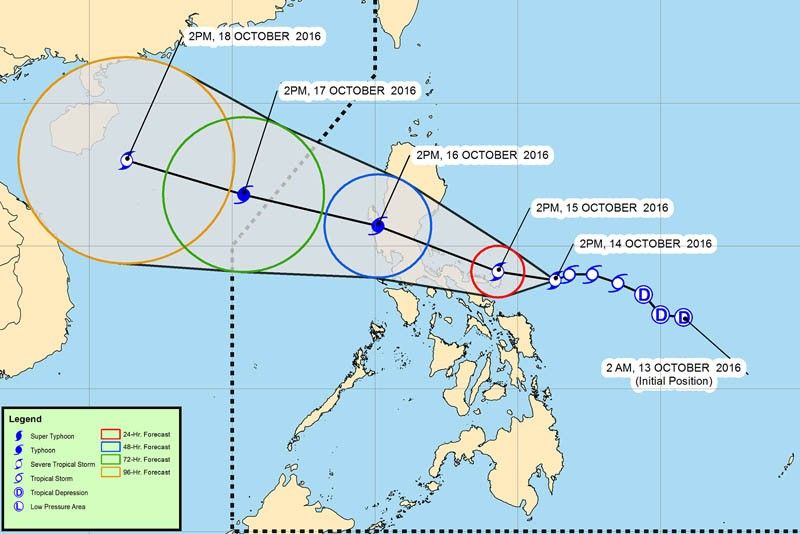
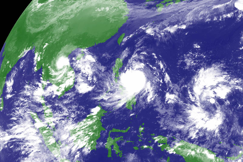
MANILA, Philippines (First update 11:01 a.m.) — Cyclone Karen intensified into a severe tropical storm as it barrels toward the the Bicol Region, aiming to across Central Luzon over the weekend.
The storm is expected to strengthen into a typhoon before making landfall over the Aurora-Quezon area on Sunday, the bureau said in a late afternoon news conference.

In its 5 p.m. advisory, PAGASA said Karen, currently moving at 9 kilometers per hour (kph), is expected to be in the vicinity of Catanduanes by Saturday afternoon.
The cyclone has maximum sustained winds of 100 kph near the center and gusts of up to 140 kph.
PAGASA hoisted storm warning signals over Catanduanes, Camarines Sur and Camarines Norte. It also warned of possible storm surge of 4.1 to 14 meters at coastal areas.
The following areas, meanwhile, are under Signal No. 1:
- Albay
- Sorsogon
- Quezon including Polillo Island
- Aurora
- Isabela
- Quirino
- Laguna
- Rizal
- Marinduque
- Ticao and Burias Island
- Masbate
- Nueva Ecija
- Bulacan
- Pampanga
- Cavite
- Batangas
- Metro Manila
- Northern Samar
The tropical storm is expected to leave the Philippine area of responsibility (PAR) on Monday afternoon.
PAGASA may also possibly raise a cyclone warning Signal No. 2 over the provinces of Quezon, Aurora, Albay and Polillio Island on Fridat evening or Saturday morning.
- Latest
- Trending


