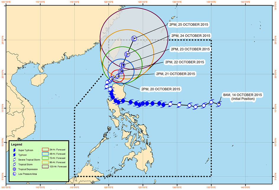
'Lando' slowly moves to extreme northern Luzon
MANILA, Philippines — Tropical Storm Lando on Tuesday afternoon continued to head toward the tip of the country as it weakened slightly, bringing heavy rains to northern Luzon.
In a 5 p.m. advisory, state weather bureau PAGASA said that as of 4 p.m., the center of "Lando" was estimated at 90 kilometers west of Calayan, Cagayan.
As it continued its slow approach to Calayan and the Babuyan Group of Islands, it is seen to move northeast at 4 kilometers per hour (kph), reaching 50 kilometers northwest of Calayan, Cagayan by Wednesday afternoon.
The storm packs maximum sustained winds of 75 kph near the center and gusts of up to 90 kph, bringing moderate to heavy to at times intense within its 650-km diameter.
Areas in northern and northwest Luzon are also alerted with public storm warning signals.
Signal No. 2
- Ilocos Norte
- Ilocos Sur
- Apayao
- Abra
- Batanes
- Northern Cagayan
- Calayan Islands
- Babuyan Islands
Signal No. 1
- La Union
- Pangasinan
- Kalinga
- Mt. Province
- Ifugao
- Benguet
- Nueva Vizcaya
- Isabela
- The rest of Cagayan
PAGASA also warned fisherfolk not to venture out over the seaboards of Luzon as occasional rains and gusty winds will be still experienced over provinces.
Residents in low-lying and mountainous areas of the provinces under storm warning signals are alerted against possible flashfloods and landslides.

PAGASA forecast track of Tropical Storm Lando as of 5 p.m. on Tuesday.
Weather platform Accuweather noted that the cyclone will continue to bring threatening conditions in the Philippines through Wednesday even as it weakened.
"Life-threatening conditions will persist across northern Luzon through the middle of the week as [Lando] drifts northward," meteorologist Eric Leister said in a post.
- Latest
- Trending


