Pagasa warns of heavy rains, strong winds
MANILA, Philippines - Filipinos should brace for heavy rains and strong winds today as typhoon “Pepeng” (international name: Parma) was forecast to make landfall over the Aurora-Isabela area this afternoon, the state weather bureau warned yesterday.
Search and rescue teams are in place in Bayombong, Nueva Vizcaya as this landlocked province aims for zero casualty from the incoming weather disturbance, feared to be the strongest typhoon to hit the Philippines so far this year.
Storm warning signal no. 3 was raised over Catanduanes as of 5 p.m. yesterday as Pepeng continued to move west-northwest toward Aurora and Isabela.
Nathaniel Cruz, deputy administrator of the Philippine Atmospheric, Geophysical and Astronomical Services Administration (Pagasa), warned that Pepeng’s intensity could topple electricity and power lines and destroy small houses.
“It is a very strong typhoon with 195 kilometers per hour of winds that can bring very heavy damage to affected communities. Even if it would not reach Category 5 (250 kilometers per hour), we have to prepare,” Cruz told reporters.
Cruz said even if the typhoon would not hit Metro Manila, it would still bring occasional but heavy rains over the metropolis today.
Cruz said the areas that would feel Pepeng’s wrath are the provinces in northern Luzon, including Aurora and Isabela.
He said the provinces of Quezon, Cagayan, Nueva Vizcaya, and Quirino “cannot be spared” by Pepeng, which has been tagged as a super typhoon by international news agencies.
He said communities in these provinces should watch out for landslides, flashfloods and storm surges.
The weather bureau said it will raise storm signal no. 4 over provinces in northern Luzon as soon as Pepeng intensifies into a super typhoon.
Meanwhile, Pagasa deputy administrator Prisco Nilo said a high pressure area (HPA) off Hong Kong has slowed down the movement of Pepeng from 19 kph at 11 a.m. to 13 kph at 4 p.m. yesterday. It was forecast to move west-northwest at 13 kph.
“This means that we will experience bad weather longer if Pepeng will slow down,” Nilo said.
Nilo said there is still a possibility that the typhoon would intensify into a super typhoon before hitting the Aurora-Isabela area.
Nilo said the HPA could also “significantly” affect the present movement of the typhoon.
“Instead of moving toward the Aurora-Isabela area it could move toward the Central Luzon area if the HPA pushes the typhoon down,” Nilo said.
“This scenario poses more danger to Metro Manila residents,” he said.
“However, there is also a slim possibility that it would recurve,” Nilo added.
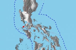
Cruz said Pepeng, packing winds of 195 kph near the center and gustiness of up to 230 kph, was spotted some 150 kilometers north northeast of Virac, Catanduanes as of 4 p.m. yesterday.
Cruz said Pepeng was expected to make a landfall over Aurora-Isabela this afternoon and cross northern Luzon.
“Pepeng would take 18 hours to cross Northern Luzon,” Nilo said.
Storm warning signals
As of 4 p.m. yesterday, signal no. 2 was up in Cagayan, Isabela, Aurora, Quirino, Northern Quezon (including Polillo Island), Camarines Norte, and Camarines Sur.
Signal no. 1 was raised over the Calayan and Babuyan groups of islands, Ilocos Norte, Ilocos Sur, Apayao, Abra, Kalinga, Mt. Province, Ifugao, Nueva Vizcaya, Benguet, La Union, Pangasinan, Tarlac, Nueva Ecija, Zambales, Bataan, Pampanga, Bulacan, Laguna, Batangas, Cavite, Rizal, the rest of Quezon, Marinduque, Albay, Burias Island, Sorsogon, and Metro Manila.
Cruz also warned the public against storm surges in areas under storm warning signals 2 and 3.
Nilo warned that the storm surges could be as strong as a tsunami.
A storm surge is an offshore rise of water associated with a low pressure weather system, typically a tropical cyclone.
Cruz said strong to gale force winds would prevail over the Visayas and Mindanao.
Mudslides possible
Meanwhile, Philippine Institute of Volcanology and Seismology (Phivolcs) Director Renato Solidum also warned residents in the Bicol region against mudslides that could be triggered by the prolonged heavy rains.
Pepeng was already pounding Bicol provinces with strong winds and rains as of yesterday.
Susan Espinueva of Pagasa’s hydro metrological division said flooded areas in Metro Manila, Laguna and Rizal have already reached the maximum water holding capacity, and even slightly heavy rains can increase floodwaters.
Espinueva said those in charge of dams across Luzon have advised the public that they may have to continuously release water during Pepeng’s onslaught to prevent spillage.
Pepeng is expected to be 50 kms south-southwest of Laoag City tomorrow afternoon and at 230 kms west-northwest of Laoag City by Monday afternoon.
Pepeng is the 16th tropical cyclone to enter the country this year and the fifth in September.
Zero casualty
Search and rescue teams are in place in Bayombong, Nueva Vizcaya as officials of the Magat hydroelectric power and irrigation project in Ramon, Isabela, have also intensified the release of excess water from the dam, in preparation for Pepeng’s expected unleashing of strong winds and rains to the region beginning today.
“All possible scenarios that may happen during the typhoon have been considered with corresponding preventive and safety measures in line with our zero casualty policy,” said Evaliza Agamata, Nueva Vizcaya calamity and disaster officer.
Residents in flood- and landslide-prone areas have also been alerted for any sudden evacuation.
Nueva Vizcaya’s traditionally flood-prone areas are the towns of Bagabag, Solano, Bambang and Bayombong which lie parallel to the Magat River.
Likewise, the mountain towns of Kasibu, Santa Fe, Kayapa, Ambaguio, Diadi and other highland areas are also being closely watched for possible landslides.
Forced evacuation
The Regional Disaster Coordinating Council (RDCC) in Pampanga ordered some 17,000 families in the province to move out of their homes by 12 noon yesterday after their areas were identified as severely threatened by the possible collapse of the Arnedo dike along the Pampanga river.
Central Luzon police director and RDCC chairman Chief Superintendent Leon Nilo de la Cruz said Defense Secretary Gilbert Teodoro imposed the deadline in the face of typhoon Pepeng, which is expected to make a landfall today in eastern Luzon. – With Charlie Lagasca, Ding Cervantes, Celso Amo, Eva Visperas


- Latest
- Trending