#RosalPH
PAGASA says low pressure area "Rosal" transitions into a post-tropical low.
As of Tuesday morning, Rosal spotted 1,020 kilometers east of extreme northern Luzon. It is moving southeastward at 10 kilometers per hour.
State weather bureau PAGASA reports that Tropical Storm Rosal slightly weakens as it continues to move away from the Philippines.
Rosal was last seen at 880 km east of Extreme Northern Luzon, packing maximum sustained winds of 75 kph and gustiness of up to 90 kph, PAGASA adds.
No tropical cyclone wind signal is hoisted due to Rosal as of Monday afternoon.
PAGASA says Tropical Depression Rosal maintains its strength while moving north northwestward over the Philippine Sea east of Quezon.
As of 4 p.m. Saturday, the center of Rosal was spotted 285 kilometers east of Infanta, Quezon.
Moving north northwestward at 15 kilometers per hour, it has maximum sustained winds of 45 kph near the center and gustiness of up to 55 kph.
PAGASA says Saturday morning that the low pressure area located off Sorsogon developed into Tropical Depression Rosal.
Stay tuned for latest developments on Tropical Depression Rosal.
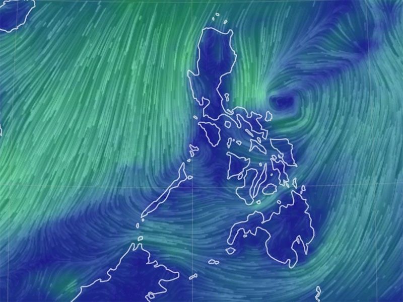
Image from Earth Null.


- Latest
- Trending