Two rescued, one missing in Pilar, Camotes Islands: Classes in Cebu suspended due to storm Kristine
CEBU, Philippines — As tropical storm Kristine continues to bring rain showers and thunderstorms, particularly in the Visayas, local government units (LGUs) in Cebu have ordered the cancellation of classes yesterday.
The Provincial Disaster Risk Reduction and Management Office (PDRRMO) reported that as of 4 p.m. 40 LGUs already made the declaration. The chartered cities of Cebu and Mandaue have also made a similar order to ensure the safety of all students.
In particular, the Cebu LGUs who issued separate orders cancelling classes for today are that of Asturias, Aloguinsan, Boljoon, Bogo City, Bantayan, Badian, Balamban, Daanbantayan, Danao City, Medellin, Madridejos, Moalboal, Oslob, Pinamungajan, Pilar.
Poro, San Remigio, Sibonga, Santa Fe, San Francisco, Santander, Sogod, Toledo City, Talisay City, Tabogon, Tabuelan, Tudela, Liloan, Cordova, Naga City, San Fernando, Ginatilan, Consolacion, Argao, Mandaue City, Catmon, Barili, Dumanjug, Carcar City, and Cebu City.
In Boljoon, Sibonga and Tabogon, the classes were suspended in all levels for public schools as early as yesterday. While in Talisay City, Mayor Samsam Gullas said the suspension of classes for private schools and Talisay City College is up to the school president.
In Cebu City, Acting Mayor Donaldo Hontiveros also ordered the suspension of classes in all levels of the city’s public and private schools, in anticipation of the danger Kristine poses to the students.
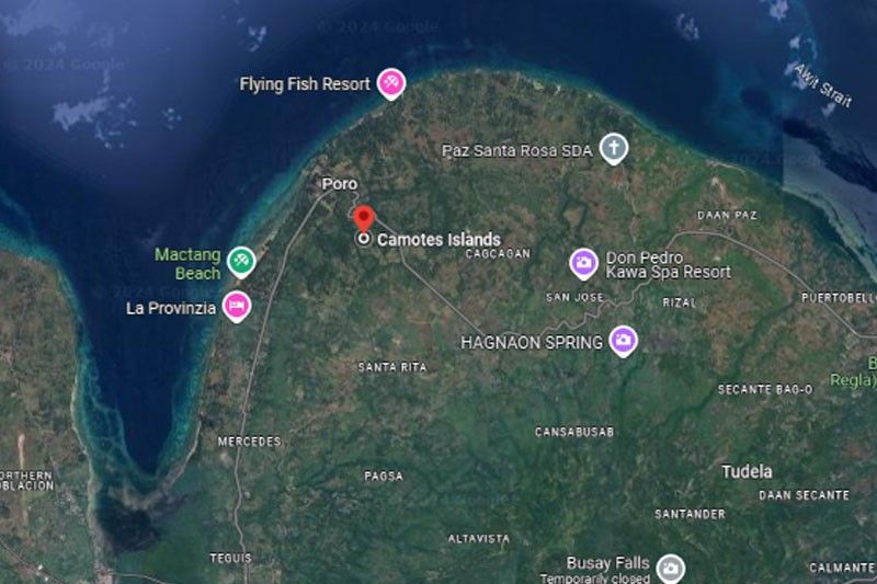
Also, the PDRRMO also reported that by 3 p.m. yesterday, sea travel from Hagnaya Port bound to Santa Fe and Masbate was already suspended, resulting in 39 being left stranded. Sea travel from Danao Port for Camotes Island and Liloan, Santander Port for Larena, Siquijor was likewise suspended.
The Coast Guard Station-Northern Cebu and Central Cebu said that due to Tropical Cyclone Wind Signal Number 1 being in effect (no storm signal yet in Cebu), “all vessel movements to or from affected areas in Luzon, Visayas, and Mindanao are temporarily suspended until further notice.”
The Cebu Port Authority likewise cancelled trips from Cebu City to Hilongos City, Dumaguete City, Siquijor province, Calbayog City, Masbate province, Ormoc City, Maasin City, Surigao City, Palompon; and Maya to Malaspascua since yesterday.
2 rescued, 1 missing in Camotes
Two passengers were rescued yesterday by personnel from the Philippine National Police and the Philippine Coast Guard (PCG) during a rescue operation off the waters of Barangay San Juan, Pilar on Camotes Islands.
The operation led to the early morning rescue of two men who were found floating, while one passenger remains missing.
According to the report, these individuals were part of a group of three men reported missing on October 21, 2024, after their motor banca disappeared en route to Pilar, Cebu.
The men are from Barangay Naungan, Ormoc City, Leyte. The rescued individuals are 31-year-old Jesse Cuabo Añasco, a truck driver, and 19-year-old Junrex Lanogan, a barangay tanod. Still missing is Rodulfo Añasco Villar, a widow and retired seaman.
Wilson Ramos, assistant head of the CPDRRMO, said the three individuals came from Ormoc City to buy livestock in Pilar town, Cebu. “We heard they were going to buy goats in Pilar,” said Ramos.
The report added that local authorities have already informed the Ormoc City government about the rescue.
Efforts are ongoing to locate the third missing individual, as the PCG in Pilar has requested assistance from the PCG in Ormoc City due to a lack of necessary assets to continue the search in challenging sea conditions caused by adverse weather.
The CPDRRMO stated they have coordinated with neighboring PCG stations across mainland Leyte province to continue the search and rescue operations, which will resume today due to time constraints yesterday.
The Matnog Port sea route in Sorsogon was likewise cancelled.
The Coast Guard District Central Visayas (CGDCV) also reported that from 12 p.m. to 4 p.m. yesterday, there were 155 passengers that were stranded and 31 vessels and 86 rolling cargo ships that were not allowed to set sail. Eight vessels and 23 motor bancas were also ordered to take shelter.
Weather bureau Philippine Atmospheric, Geophysical, and Astronomical Services Administration (PAGASA), in its Tropical Cyclone Bulletin #7 issued at 5 p.m. yesterday and valid until the next advisory at 11 p.m. last night, Tropical Storm Kristine slightly intensified over the Philippine Sea east of Bicol Region.
Based on the same bulletin, Kristine is located 390 kilometers east of Daet, Camarines Norte, with maximum sustained winds of 75 kilometers per hour near the center and with a gustiness of 90 kilometers per hour. It is moving west northwestward at 15 kilometers per hour.
Tropical Cyclone Wind Signal (TCWS) number 2 is in effect in Catanduanes, the eastern portion of Camarines Norte (Basud, Daet, Talisay, Vinzons, Paracale, Mercedes), the eastern portion of Camarines Sur (Caramoan, Presentacion, Garchitorena, Tinambac, Siruma, Lagonoy, Goa, San Jose, Saglay, Tigaon), the eastern portion of Albay (Rapu-Rapu, Bacacay, City of Tabaco, Malilipot, Malinao, Tiwi) and the eastern portion of Sorsogon (Barcelona, Gubat, Prieto Diaz) in Luzon.
The northeastern portion of Northern Samar (Palapag, Mapanas, Gamay, Laoang, Catubig, Lapinig, Pambujan, San Roque) and the northern portion of Eastern Samar (Jipapad, San Policarpo, Arteche) were also under TCWS number 2.
Signal number 1, on the other hand, was raised in Luzon areas like Ilocos Norte, Ilocos Sur, La Union, Pangasinan, Apayao, Kalinga, Abra, Mountain Province, Ifugao, Benguet, Cagayan including Babuyan Islands, Isabela, Quirino, Nueva Vizcaya, Aurora, Nueva Ecija, Tarlac, Zambales, Bataan, Pampanga, Bulacan, Metro Manila, Cavite, Laguna, Batangas, Rizal, Quezon including Polillo Islands, Occidental Mindoro including Lubang Islands, Oriental Mindoro, Masbate including Ticao and Burias Islands, Marinduque, Romblon, the rest of Camarines Norte, the rest of Camarines Sur, the rest of Albay, and the rest of Sorsogon.
In Visayas, the rest of Eastern Samar, the rest of Northern Samar, Samar, Leyte, Biliran, and Southern Leyte were also under signal number 1, including Dinagat Islands, Surigao del Norte, Siargao, and the Bucas Grande Group in Mindanao.
Kristine is forecasted to move generally northwestward until it makes landfall over Isabela or northern Aurora around evening today, Oct. 23, or early morning of Oct. 24.
It would then cross the mountainous terrain of Northern Luzon and emerge over the waters west of Ilocos Region on Thursday afternoon or evening before exiting the Philippine Area of Responsibility (PARD) on Friday, Oct. 15.
The weather bureau added that Kristine may exit the Philippine Area of Responsibility (PAR) on Friday, Oct. 25.
“Changes in forecast track are not ruled out, depending on the movement of the weather systems surrounding this tropical cyclone in the next few days,” PAGASA said.
It added that Kristine is forecast to gradually intensify into a severe tropical storm before making landfall.
“Slight weakening will occur while crossing Northern Luzon. Re-intensification may occur over the West Philippine Sea,” it said.
Engr. Al Quiblat, PAGASA Visayas chief, advised Cebuanos to continue to be vigilant and to remain cautious about the winds, which may strengthen and reach speeds of 40 to 60 km/h, similar to conditions associated with TCWS No. 1.
“Mokusog pa gyud ang hangin diri sa Cebu and more mas kusog didto sa laing lugar. Example gikan sa Cebu moadto sila sa Eastern Visayas, kay duna may signal karon sa Eastern Visayas,” he said during a phone interview.
He also said Kristine could become a severe tropical storm before making landfall, but it would reach typhoon category only after exiting the PAR.
“Dili ni mo-typhoon category based sa atong latest forecast analysis within PAR, which is a good news kay adto na siya ma-typhoon category iniggawas sa PAR by Friday or Saturday,” he said.
As of writing, no untoward incident was received by the PDRRMO from the towns and cities due to the bad weather. — (FREEMAN)


- Latest