'Karen' downpour threatens to trigger floods, landslides in Luzon
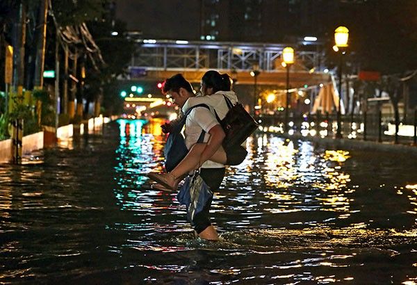
MANILA, Philippines (Philippines News Agency) - Communities in Metro Manila, central Luzon, the Calabarzon region and northern Luzon must brace for possible flash floods and landslides from the expected rainfall of Typhoon Karen (international name Sarika), which experts don't expect to weaken soon.
The Philippine Atmospheric, Geophysical and Astronomical Services Administration (PAGASA) forecast 'Karen' to make a landfall in Luzon's Quezon-Aurora area on Sunday morning but not lose steam while crossing landmass, bringing moderate to heavy rainfall to these areas.
"Available information indicate Karen will cross Luzon still as a typhoon, so communities in those areas must prepare accordingly," said PAGASA weather forecaster Dennison Estareja.
Karen developed into a typhoon late Friday while nearing land and continues to intensify, so it is unlikely for the weather disturbance to weaken soon after making landfall, unlike other tropical cyclones, he explained.
In its severe weather bulletin released at 11 a.m. Saturday, PAGASA said Karen has passed north of Catanduanes and was already moving towards the Aurora-Quezon area, packing maximum sustained winds of up to 130 kph near its center and gustiness of up to 180 kph.
Estimated rainfall amount is from moderate to heavy within the 500-km diameter of the typhoon.
Headlines ( Article MRec ), pagematch: 1, sectionmatch: 1
Estareja said stormy weather is expected in the northern Bicol region on Saturday and Sunday.
Stormy weather is also likely in Aurora, Polillo Island and northern areas of Quezon, PAGASA warned in its 24-hour forecast released Saturday.
Tropical cyclone warning Signal No. 3 is already prevailing over Catanduanes, Camarines Norte and Aurora, as well as Quezon’s northern areas and Polilio Island.
Such areas can expect in 18 hours winds of 121 kph to 170 kph, and storm surges more than 14 meters high are possible in coastal areas there, warned PAGASA.
The bureau forecast Karen to move west-northwest at 15 kph, faster than the 13 kph it reported earlier.
Karen will likely be 110 km northeast of Quezon's Infanta municipality by Sunday morning and 325 km west-northwest of Zambales' Iba municipality by Monday morning.
"We expect 'Karen' to exit the Philippine Area of Responsibility on Monday morning," said Estareja.
The government already raised Signal No. 2 over the rest of Quezon as well as Camarines Sur, Albay, Rizal, Bulacan, Nueva Ecija and Quirino, expecting there in 24 hours winds reaching 61 kph to 120 kph.
Storm surges of up to 14 meters high are also possible there, said PAGASA.
Signal No. 1 is prevailing over Sorsogon, Masbate including Ticao and Burias Island, Isabela, Romblon, Marinduque, Oriental Mindoro, Batangas, Laguna, Cavite, Pampanga, Bataan, Zambales, Tarlac, Pangasinan, Nueva Vizcaya, La Union, Benguet and Ifugao, all in Luzon, Metro Manila and the Visayas’ northern Samar.
Such areas can experience in 36 hours 30 kph to 60 kph winds, said PAGASA.
Waves in seas off the areas can reach up to 4 meters high, PAGASA added.


- Latest
- Trending