‘Pepito’ makes 2nd landfall hitting Aurora, Quirino — PAGASA

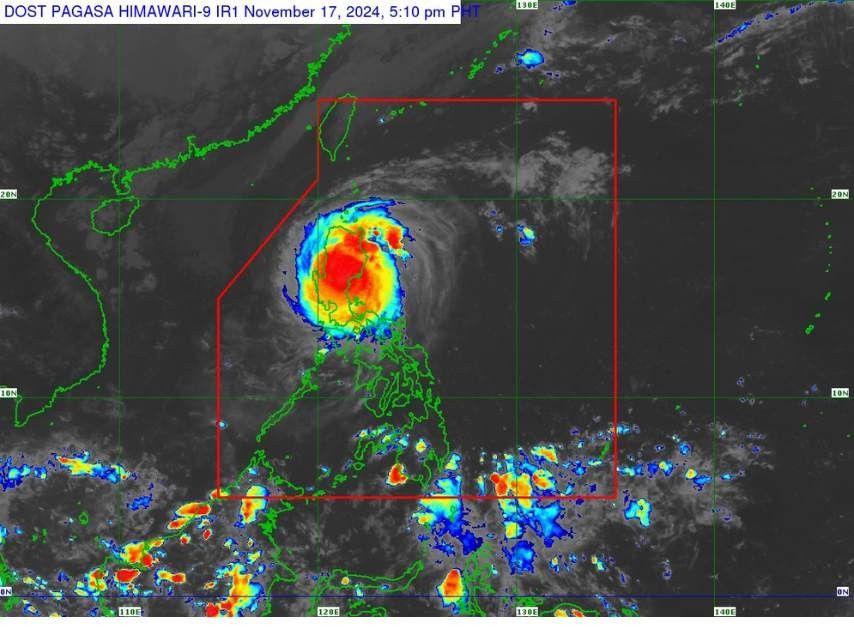
MANILA, Philippines — Super Typhoon "Pepito" (international name: Man-Yi) made its second landfall in Dipaculao, Aurora, at 3:20 p.m. on Sunday, November 17 and is now traversing Quirino Province, bringing intense winds and torrential rainfall across northern and central Luzon.
As of 4 p.m., Pepito's center of the eye was located in the vicinity of Nagtipunan, Quirino (16.1°North, 121.5°East). It packs maximum sustained winds of 185 kilometer per hour near the center, gustiness of up to 305 kph and central pressure of 935 hPa
Tropical Cyclone Wind Signals (TCWS)
Signal No. 5
PAGASA placed the following under TCWS No. 5:
- Central Aurora
- Dipaculao
- Baler
- Dinalungan
- Maria Aurora
- Casiguran
- San Luis
- Southern Quirino (Nagtipunan)
- Southern Nueva Vizcaya
- Alfonso Castañeda
- Dupax del Norte
- Dupax del Sur
- Kasibu
- Aritao
- Bambang
These areas are under extreme threat to life and property, according to PAGASA, with destructive winds surpassing 185 kph anticipated within the next 12 hours.
Signal No. 4
The rest of Aurora
The rest of Nueva Vizcaya
The rest of Quirino
The southern portion of Ifugao:
- Kiangan
- Lamut
- Tinoc
- Asipulo
- Lagawe
Benguet
The southern portion of Ilocos Sur:
- Alilem
- Sugpon
- Suyo
- Santa Cruz
- Tagudin
La Union
The eastern portion of Pangasinan:
- Sison
- Tayug
- Binalonan
- San Manuel
- Asingan
- San Quintin
- Santa Maria
- Natividad
- San Nicolas
- Balungao
- Pozorrubio
- Laoac
- San Jacinto
- San Fabian
- Manaoag
- City of Urdaneta
- Rosales
- Umingan
- Mangaldan
- Mapandan
- Villasis
- Santo Tomas
The northern portion of Nueva Ecija:
- Gabaldon
- Laur
- Bongabon
- Pantabangan
- Rizal
- General Mamerto Natividad
- Lupao
- San Jose City
- Llanera
- Carranglan
- Science City of Muñoz
- Talugtug
- Cuyapo
These areas are under significant to severe threat to life and property to life and property, according to Pagasa, with destructive winds surpassing 118 to 184 kph anticipated within the next 12 hours.
Signal No. 3
The southern portion of Isabela:
- San Agustin
- Jones
- Echague
- San Guillermo
- Angadanan
- Alicia
- San Mateo
- Ramon
- San Isidro
- City of Santiago
- Cordon
- Dinapigue
- Roxas
- Aurora
- Cabatuan
- City of Cauayan
- Luna
- San Mariano
- Benito Soliven
- Naguilian
- Reina Mercedes
- San Manuel
- Burgos
The rest of Ifugao
Mountain Province
The southern portion of Kalinga:
- Pasil
- Tanudan
- Lubuagan
- Tinglayan
The southern portion of Abra:
- Tubo
- Luba
- Pilar
- Villaviciosa
- San Isidro
- Pidigan
- Langiden
- San Quintin
- Bangued
- Manabo
- Boliney
- Peñarrubia
- Bucloc
- Sallapadan
- Bucay
The rest of Ilocos Sur
The rest of Pangasinan
The northern and eastern portions of Tarlac:
- Paniqui
- La Paz
- Moncada
- City of Tarlac
- Gerona
- Pura
- San Clemente
- Santa Ignacia
- Victoria
- Camiling
- Concepcion
- Ramos
- San Manuel
- Anao
The rest of Nueva Ecija
The northern portion of Bulacan:
- Doña Remedios Trinidad
- San Miguel
The northern portion of Quezon:
- Infanta
- General Nakar
- Including Polillo Islands
These areas face a moderate to significant threat to life and property, with storm-force winds ranging from 89 to 117 kph expected within 18 hours.
Signal No. 2
The rest of Isabela
The southwestern portion of mainland Cagayan:
- Enrile
- Tuao
- Solana
- Tuguegarao City
- Piat
- Rizal
The rest of Kalinga
The southern portion of Apayao:
- Conner
- Kabugao
The rest of Abra
Ilocos Norte
Zambales
The rest of Tarlac
The northern portion of Bataan:
- Orani
- Abucay
- Hermosa
- Samal
- Dinalupihan
Pampanga
The rest of Bulacan
Metro Manila
Rizal
The northeastern portion of Laguna:
- Santa Cruz
- Pila
- Mabitac
- Paete
- Pagsanjan
- Pangil
- Santa Maria
- Siniloan
- Cavinti
- Kalayaan
- Lumban
- Pakil
- Famy
The central portion of Quezon:
- Sampaloc
- Mauban
- Perez
- Real
These areas face a minor to moderate threat to life and property, with gale-force winds ranging from 62 to 88 kph expected within 24 hours.
Signal No. 1
- The rest of mainland Cagayan
- The rest of Apayao
- The rest of Bataan
- Cavite
- The rest of Laguna
- Batangas
- The rest of Quezon
- The northern portion of Occidental Mindoro:
- Abra de Ilog
- Paluan
- Lubang Islands
- The northern portion of Oriental Mindoro:
- Puerto Galera
- San Teodoro
- Naujan
- Baco
- City of Calapan
- Marinduque
- Camarines Norte
- The northern portion of Camarines Sur:
- Libmanan
- Tinambac
- Siruma
- Cabusao
- Canaman
- Magarao
- Calabanga
- Bombon
- Sipocot
- Ragay
- Del Gallego
- Lupi
- Lagonoy
- Goa
- Garchitorena
- Pasacao
- Pamplona
- Camaligan
- Gainza
These areas face a minimal to minor threat to life and property to life and property, with gale-force winds ranging from 39 to 61 kph expected within 36 hours.
Coastal and marine hazards
A high risk of life-threatening storm surge is forecast within the next 48 hours, with peak surge heights exceeding three meters in low-lying or exposed coastal areas of the Ilocos Region (western coast), southeastern mainland Cagayan, Isabela, Central Luzon, Metro Manila, Cavite, southeastern Batangas and Quezon Province.
A gale warning remains in effect for the eastern seaboard of Luzon and the western seaboards of Northern and Central Luzon.
PAGASA also warned that sea travel is considered risky for all types of vessels due to expected very rough to high sea conditions, with wave heights reaching up to nine meters in Aurora and eight meters in Isabela.
Mariners and seafarers are strongly urged to remain in port or seek safe shelter immediately until conditions improve and winds and waves subside.
Forecast track
After making landfall, Pepito is now crossing the northern portion of Central Luzon and the southern portion of Northern Luzon, traversing the upland regions of Sierra Madre, Caraballo and Cordillera Central.
The cyclone is expected to exit Luzon’s landmass tonight or early tomorrow morning, November 18, as it weakens due to land interaction.
Once over the West Philippine Sea, Pepito will move west-northwestward and is forecast to exit the Philippine area of responsibility (PAR) by November 18, morning or noon.
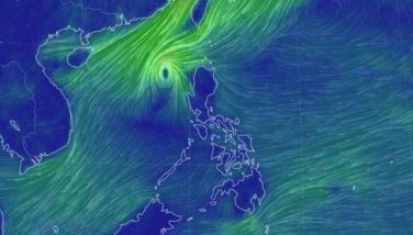
Outside PAR, it will likely shift westward or west-southwestward by Tuesday, November 19, influenced by a northeasterly wind surge that will further weaken the typhoon due to unfavorable conditions.
Despite forecasts of the super typhoon weakening, PAGASA warned that heavy rainfall, strong winds, and storm surges remain a threat to areas outside the landfall point and confidence cone.
Residents are advised to monitor updates as Pepito’s track may still shift within the forecast range.
- Latest
- Trending


