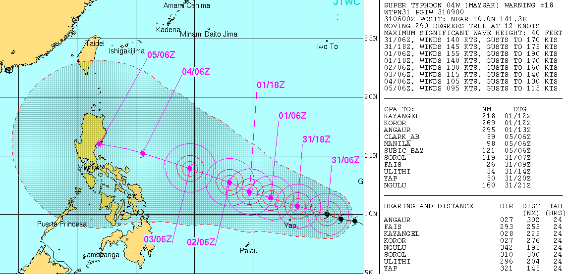
US agency upgrades 'Maysak' to super typhoon
MANILA, Philippines — The tropical cyclone "Maysak" over the northwest Pacific Ocean continued to intensify into a super typhoon on Tuesday, the United States' Joint Typhoon Warning Center said.
Within 24 hours, the agency indicated Maysak may reach maximum sustained winds of 287 kilometers per hour (kph) and gusts of up to 351 kph.
It is also expected to slightly slow down to winds of up to 277 kph and gustiness of up to 314 kph by Wednesday.
UPDATE TO THIS STORY: 'Chedeng' to enter PAR tonight | LIVE UPDATES: Tropical cyclone 'Chedeng'
Some homes on a western Pacific Ocean island have been destroyed by typhoon-force winds, were expected to bear down on a neighboring island in the Federated States of Micronesia.
"A lot of houses and roofs were blown away, and trees and telephone poles on the main road were blown down," Kane Faylim, airport manager for Chuuk state government, told The Associated Press on Tuesday.
The National Weather Service in Guam said residents on Yap Island could experience winds of 119 kph or higher from Typhoon Maysak early Wednesday morning. Telephone calls to the island were not connecting.
Widespread damage was reported in Chuuk, which suffered damage Monday.
Many homes made out of tin were destroyed, said Perry Killion, a pastor who also works at the National Weather Service office in Chuuk. Many residents were without water and sought shelter at schools, he told the Pacific Daily News, a newspaper in Guam.
As it nears the Philippines' landmass on Friday, the Hawaii-based agency expects the weather disturbance to further slow down to 194 kph winds and 240 kph gusts.
Weakening within PAR
Under PAGASA classification, meanwhile, the cyclone may fall under the lower "typhoon" category of 118 to 220 kph as it approaches the Philippine landmass by weekend. It will then be named "Chedeng."
In its 11 a.m. advisory on Tuesday, PAGASA said "Maysak" was located 1,820 kilometers east of northern Mindanao.
"This typhoon is still too far to affect any part of the country. It is expected to enter the Philippine Area of Responsibility tomorrow evening or Thursday early morning," the state weather bureau said.
PAGASA will have a more accurate forecast of the typhoon when it enters PAR by Thursday night or Wednesday morning.
Weather service meteorologist Derek Williams said Tuesday afternoon that Maysak is expected to hit the Philippines on Sunday or Monday.
"Its official track has it straight toward Luzon," he said.
Williams also said the storm is expected to weaken significantly when it gets to the Philippine Sea, but the storm is still expected to cause widespread damage there such as flooding. - with reports from Grace Garces Bordallo, Associated Press
- Latest
- Trending


