#HenryPH
Super typhoon Henry slightly intensifies as it moves south southwestward northeast of Batanes, state weather bureau PAGASA says in its 11 a.m. bulletin.
‘Henry’ is last located at 430 km east northeast of Itbayat, Batanes, packing maximum sustained winds of 195 kph near center.
PAGASA reiterates that the super typhoon is expected to enhance the southwest monsoon or habagat which may bring rains over the western section of Luzon starting Friday.
Tropical Cyclone Wind Signals may also be hoisted over areas in the extreme northern Luzon within Thursday. “The potential for hoisting a Wind Signal No. 2 is also not ruled out,” PAGASA adds.
“Henry” has strengthened into a tropical storm and is now outside the Philippine area of responsibility, state weather bureau, PAGASA says.
PAGASA has lifted all tropical cyclone warning signals as “Henry” leaves the Philippine territory Tuesday morning.
State weather bureau PAGASA lifts Tropical Cyclone Warning Signal number 1 over Batanes and the northern parts of Cagayan and Apayao Tuesday morning as Tropical Depression Henry continues to move westward.
Only the Babuyan Group of Islands and northern portion of Ilocos Norte are under Tropical Cyclone Warning Signal number 1.
"Henry" was last seen 230 km west of Calayan, Cagayan.
Senior Associate Justice Antonio Carpio, acting chief justice, has suspended work for Supreme Court personnel from noon on Tuesday.
Presiding justices and executive judges of other courts have the discretion to call off work "considering their specific circumstances."
URGENT ADVISORY: SAJ Antonio Carpio suspends work for SC personnel starting at 12NN today, July 17; discretion is given to PJs and EJs to suspend work considering their specific circumstances. pic.twitter.com/IVBeiBuCfo
— Supreme Court PIO (@SCPh_PIO) July 17, 2018
Manila Mayor Joseph Estrada has likewise announced the suspension of work at Manila City Hall because of rains and flooding.
Work at the Senate was suspended earlier Tuesday morning by Sen. Gregorio Honasan II, Senate OIC.
The Metro Manila Development Authority issued flood alerts on Tuesday morning due to rains brought by tropical depression Henry.
Here's a list of flooded areas in Metro Manila as announced by the MMDA:
- Quirino Guazon (as of 6:52 a.m. - gutter deep, passable to all types of vehicle)
- EDSA Ortigas POEA southbound (as of 7 a.m. - gutter deep, passable to all types of vehicle)
- Roxas Blvd Kalaw southbound (as of 6:52 a.m. - half tire, not passable to light vehicle)
- Ortigas La Salle gate 6 (as of 7:15 a.m. - gutter deep, passable to all types of vehicle)
- EDSA Taft MRT northbound (as of 7:28 a.m. - gutter deep, passable to all types of vehicle)
- Commo, Doñacarmen (as of 6:52 a.m. - half tire, not passable to light vehicle)
- EDSA Aurora tunnel northbound/southbound (as of 8:30 a.m. - gutter deep, passable to all types of vehicle)
According to the PAGASA Severe Weather Bulletin issued early Tuesday morning, "Henry" was 95 km west of Calayan, Cagayan and moving west northwest at 20 kph.
The tropical depression has maximum sustained winds of 60 kph near the center and gustiness of up to 75 kph.
Tropical Cyclone Warning Signal No. 1 is still hoisted over the following areas:
- Batanes
- Northern portion of Cagayan, including Babuyan Group of Islands
- Northern portion of Apayao
- Northern portion of Ilocos Norte
"Henry" has maintained its strength and is now threatening the northern Cagayan area, PAGASA says.
It packs maximum sustained winds of 60 kph near the center and gustiness of up to 75 kph. By tomorrow afternoon, it is forecast to be outside the Philippine area of responsibility at 690 km west of Calayan, Cagayan.
PAGASA raised Signal No. 1 over Batanes, the northern portion of Cagayan including Babuyan Group of Islands, the northern portion of Apayao and the northern portion of Ilocos Norte.
State weather bureau PAGASA says Tropical Depression Henry has intensified and sped up slightly as it moves closer to extreme northern Luzon Monday afternoon.
“Henry” packs maximum sustained winds of 60 kilometers per hour from the previous 55 kilometers per hour and gustiness of up to 75 kilometers per hour from the previous 65 kilometers per hour.
It is now moving west at 35 kilometers per hour.
Tropical Depression Henry has kept its strength and speed as it continues to move westward toward extreme Northern Luzon, state weather bureau PAGASA says.
Tropical Cyclone Warning Signal No. 1 is still up over Batanes and the northern parts of Apayao, Ilocos Norte and Cagayan including Babuyan Group of Islands as of Monday afternoon.
Tropical Depression Henry has maintained its strength while moving toward extreme Northern Luzon, state weather bureau PAGASA says.
In its 11 am bulletin, PAGASA reports that “Henry” packs maximum sustained winds of 55 kilometers per hour and gustiness of up to 65 kilometers per hour. It has slightly slowed down at 25 kilometers per hour.
Tropical Cyclone Warning Signal No. 1 is still up over Batanes and the northern parts of Apayao, Ilocos Norte and Cagayan including Babuyan Group of Islands.
“Henry” is expected to leave the Philippine Area of Responsibility by Tuesday.
State weather bureau PAGASA says Tropical Depression Henry has slightly accelerated as it heads toward extreme Northern Luzon.
Batanes and the northern portions of Apayao, Ilocos Norte and Cagayan including Babuyan Group of Islands remain under Tropical Cyclone Warning Signal No. 1.
Tropical Cyclone Warning Signal No. 1 has been raised over the following areas because of Tropical Depression Henry:
- Batanes
- Northern portion of Cagayan, including Babuyan Group of Islands
- Northern portion of Apayao
- Northern portion of Ilocos Norte
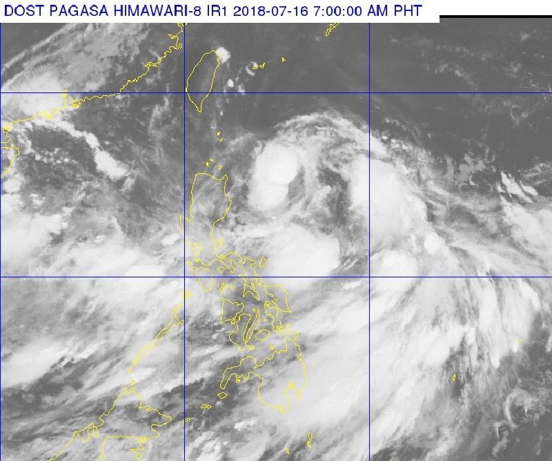
"Henry" entered the Philippine Area of Responsibility as a low-pressure area on Sunday. PAGASA said then that it would have no direct effect on the country nor was it expected to make landfall..


- Latest
- Trending